The Kilembe Trail: The Complete Expert Guide to the Rwenzori Mountains’ Most Immersive Trekking Route
The definitive guide to the Kilembe Trail in Uganda’s Rwenzori Mountains. Camps, peaks, itineraries, costs, and expert advice for trekking to Margherita Peak (5,109 m). A definitive guide for trekkers and mountaineers planning an expedition on the Kilembe Trail in the Rwenzori Mountains of Uganda.
There is a mountain range in equatorial Africa that does not announce itself with a perfect volcanic cone or the deceptively simple promise of a well-worn tourist trail. Ptolemy’s fabled Mountains of the Moon, the Rwenzori Mountains, rise instead from the deep-green flanks of western Uganda in a brooding mass of ice-carved ridges, moss-draped valleys, and cloud-wrapped glaciers that refuse to behave like any other mountain on Earth. They are cold when they should be warm, wet when Africa is dry, and alien in a landscape that elsewhere looks entirely familiar. And winding southward through the heart of this UNESCO World Heritage Site, hugging the Nyamwamba River valley before climbing through five distinct ecosystems to the roof of Uganda, runs one of the continent’s most extraordinary trekking routes: the Kilembe Trail.
The Kilembe Trail is not simply an alternative way up the mountain. It is an entirely unique journey, starting in the former copper-mining town of Kilembe on the southern edge of Rwenzori Mountains National Park, going through terrain that the more famous Central Circuit Trail never touches, and taking trekkers to the summit plateau of Mount Stanley and its highest point, Margherita Peak, at 5,109 metres, the third-highest point in Africa, along a route with waterfalls, historical footnotes, and some of the most dramatic high-altitude scenery in the tropics.
This guide is written by the team at Rwenzori Trekking Safaris, the specialist mountaineering operator that has guided expeditions exclusively in the Rwenzoris for over a decade. Every camp description, every distance figure, and every altitude note in this article has been walked, checked, and re-walked by our guides, men and women of the Bakonzo people who have lived alongside these mountains their whole lives. If you are seriously planning a Kilembe Trail trek, you have found the right resource. Read every section; by the end, you will know this trail better than most who have already climbed it.
The Kilembe Trail: History, Origin, and What Makes It Unique
The story of the Kilembe Trail reaches back to 1895, when British botanist and geographer Professor George Francis Scott Elliot pushed into the Rwenzori during an expedition that would eventually produce the first systematic botanical record of the range’s extraordinary flora. Scott Elliot crossed the high mountain pass that today bears his name, the Scott Elliot Pass, which sits between the Speke and Baker massifs at roughly 4,372 metres and his route broadly traces what trekkers now walk on the upper sections of the Kilembe Trail. His name remains carved into the geography of these mountains, a permanent tribute to one of early African exploration’s less-celebrated but more botanically significant figures.
Yet the modern Kilembe Trail as a managed trekking route is far more recent. It was officially launched in 2011 by Rwenzori Trekking Services (RTS), the holder of the trail management concession operating under the authority and oversight of the Uganda Wildlife Authority (UWA). The trail was developed to provide an alternative to the Central Circuit’s northern trailhead at Nyakalengeji/Ibanda, starting instead from the mining town of Kilembe near Kasese. This southern approach meant that the Kilembe Trail would traverse the Nyamwamba River valley, a spectacularly deep, waterfall-rich corridor that the older route entirely bypasses, and would introduce trekkers to a sequence of mountain camps positioned at lower elevations than those on the Central Circuit, creating gentler daily altitude gains and a more forgiving acclimatisation profile in the early stages.
The Kilembe Trail is not just a newer route; it is a fuller one. It connects the social and industrial history of western Uganda’s copper-mining heritage to some of the highest and most dramatic terrain on the African continent.
What truly distinguishes the Kilembe Trail from every other Rwenzori route is its depth of context. You begin in a town shaped by colonial-era copper extraction, where the remnants of the Kilembe Mines still visible on the valley floor speak of a different era of human relationship with these mountains. You enter the park through lush montane forest that is measurably different in character from the northern forest belt: wetter, denser, more vine-threaded. You pass through a sequence of vegetation zones that compress decades of botanical evolution into just a few thousand vertical metres. And you reach the high peaks through a landscape of heather moorland, giant lobelias, and Afro-alpine bog that feels like no other place on Earth. Very few mountain trails anywhere in the world pack this much ecological and historical texture into a single journey.
Where Does the Kilembe Trail Go? Route Overview and Logistics
The Kilembe Trail begins at the Kilembe Trailhead on the southern edge of Rwenzori Mountains National Park, located approximately 12 kilometers east of Kasese town in Kasese District, western Uganda. Kasese lies roughly 420 kilometers southwest of Kampala by road and has daily buses, shared taxis, and private transfers. The town makes an excellent base for pre- and post-trek nights, and our accommodation guide for trekkers covers all the reliable options in the area.
From the trailhead at roughly 1,600 metres above sea level, the route ascends steadily through montane rainforest, following the valley of the Nyamwamba River before climbing north and then west toward the central peaks. The full summit itinerary covers approximately 70–80 kilometers of cumulative trail distance across the return journey, though the distance varies depending on which specific peaks and passes are included. The elevation gain from the trailhead to the Margherita Peak summit is approximately 3,509 metres, making it one of the more significant altitude gains on any African trekking route.
Crucially, the Kilembe Trail is not a strict out-and-back route. On most itineraries, trekkers ascend to Margherita via the Bugata and Margherita Camp approach, summit the peak, and then descend by a slightly different line, sometimes crossing the Scott Elliot Pass and traversing toward the upper Central Circuit camps before returning via Kilembe or descending a more direct line back through the Nyamwamba valley. The exact descent path depends on the specific itinerary chosen, and our guides tailor the route based on group pace and conditions.
The trail is not suitable for self-guided trekking. All trekkers entering Rwenzori Mountains National Park must have licensed guides, and they must also have porters on any route reaching the high alpine zones. The UWA permit system, managed at the Kilembe park gate, requires that all trekking activity be booked through an authorized operator. As the specialist on-the-ground team for Kilembe Trail expeditions, Rwenzori Trekking Safaris handles all permits, guide assignments, and equipment logistics on your behalf.
The Kilembe Trail Camps: A Stage-by-Stage Altitude Guide
The Kilembe Trail is structured around a series of permanent mountain camps, each positioned within a specific vegetation and altitude zone. Understanding these camps, their elevations, their characters, and the terrain between them is essential for assessing whether a particular itinerary provides enough acclimatisation time to summit safely. Below is a detailed account of every camp on the trail.
Kilembe Trailhead and Forest Camp (~1,600–2,600 m)
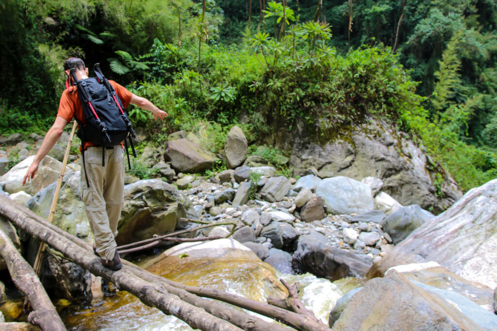
All Kilembe Trail expeditions begin at the park gate in Kilembe, where the team assembles and staff check permits. After a short briefing, the trail enters the park immediately and drops into the montane rainforest belt, one of the richest and least-visited forest environments in East Africa. The forest here is strikingly different from the northern Rwenzori forest; the canopy is denser, the understory more tangled, and the sound of the Nyamwamba River threading through the valley below is a constant companion in the lower hours of the ascent.
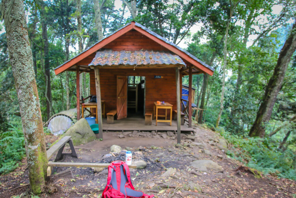
Forest Camp, reached in approximately five to six hours of hiking from the gate, sits at around 2,600 metres and marks the transition zone between the lowland forest and the higher montane belt. The camp itself is a wooden hut and cleared ground set in a small clearing where the canopy begins to thin. Evenings here feel cool and moist, with mist forming quickly after sundown. Many trekkers are surprised by how physically demanding the lower forest section is; the path is frequently slippery, root-crossed, and relentlessly inclined, and the heat of the lower elevations adds to the exertion. Appropriate footwear from the very first step is not negotiable.
Sine Camp (~2,637 m)
Just above Forest Camp lies Sine Camp, the first dedicated camp on many standard Kilembe Trail itineraries. Sine Camp, at approximately 2,637 metres, is a popular overnight stop for those on the 2-day Sine Camp short trek, which is a superb introductory experience for those not ready for the full summit push, as well as a staging camp for longer expeditions. The camp sits in open heather heath that begins to take on the character of the upper Rwenzori, and the first giant heathers (Erica excelsa) become visible in the vegetation surrounding the clearing. The three-horned chameleon, endemic to the Rwenzori and one of the mountain’s most photographed residents, is frequently spotted on the trail between Forest Camp and Sine.
Kalalama Camp (~3,134 m)
The ascent from Sine to Kalalama passes through what many experienced Rwenzori guides consider the most botanically spectacular section of the entire trail. The forest transitions through bamboo groves and Podocarpus woodland before giving way to the heather and moss zone, where ancient tree heathers draped in old man’s beard lichen create a cathedral-like atmosphere of filtered green light and deep silence. Kalalama Camp, at 3,134 metres, is set in this transitional zone and offers a genuinely restorative overnight experience: the air is crisp, the views across the valley begin to open, and the sense of having entered a different world from the sweating lowland forest below is palpable.
This is the section of trail where the Rwenzori’s unique wildlife becomes most diverse. Rwenzori turacos flash emerald and crimson across the heather canopy. African olive pigeons feed on figs at the forest edge. The Rwenzori double-collared sunbird, found nowhere else on Earth, hovers at giant lobelias that have begun to appear on the higher slopes. The trail between Sine and Kalalama, particularly in the early morning hours, is as fine a birdwatching walk as any in Uganda.
Mutinda Camp (~3,688 m)
Above Kalalama, the trail climbs out of the heather zone and into the moorland, a landscape of tussock grasses, sphagnum moss, and the extraordinary giant groundsels (Senecio rwenzoriensis), which have become the visual signature of the Rwenzori high-altitude zones. Mutinda Camp, at 3,688 metres, is set within this otherworldly terrain and commands panoramic views in virtually every direction, simply breathtaking on a clear morning. Looking south and west, the landscape falls away toward the Congolese plains far below. Looking north and east, the jagged profiles of the higher Rwenzori peaks dominate the skyline.
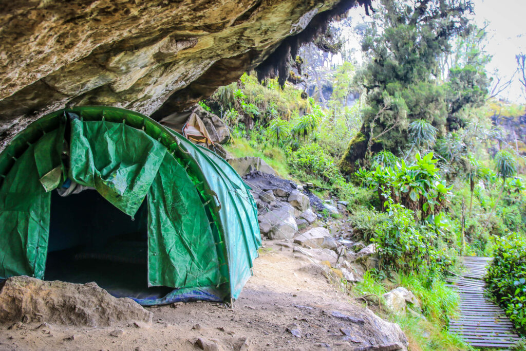
Mutinda Camp is the turnaround point for those trekking the 4-day Mutinda Lookout circuit, one of the most popular shorter Kilembe Trail itineraries and an outstanding choice for trekkers who want a genuine high-altitude Rwenzori experience without committing to a full summit attempt. At this elevation, the acclimatisation principles that underpin safe high-altitude trekking become especially important: spending a full rest day at Mutinda, even if the itinerary allows progress, is a sound strategy for those targeting Margherita.
Bugata Camp (~4,062 m)
The terrain between Mutinda and Bugata is some of the most technically demanding walking on the entire Kilembe Trail. The path traverses stretches of Afro-alpine bog, the notorious Rwenzori mud that has humbled expeditions since the mountains were first explored, crosses rocky ridgelines, and begins the serious business of altitude exposure. Bugata Camp, at 4,062 metres sits in the alpine zone proper, with direct views of the glaciated peaks above and the full drama of the high Rwenzori landscape visible on all sides.

The altitude at Bugata is sufficient to cause genuine altitude sickness in trekkers who have moved too fast in the lower camps. The classic symptoms, headache, nausea, and disrupted sleep, must be taken seriously here. Our guides are trained in altitude medicine and carry the equipment to assess symptoms and, if necessary, to initiate a safe descent. No summit attempt is worth the risk of ignoring warning signs at Bugata, and a well-rested, well-hydrated night here pays significant dividends on summit day.
Hanwick’s Camp (~3,874 m)
Hanwick’s Camp is one of the Kilembe Trail’s structural features that most clearly distinguishes it from other Rwenzori routes: its deliberate back-stepping for acclimatisation. The camp sits at 3,874 metres below Bugata and is used on certain itineraries as a ‘sleep low’ camp after a ‘climb high’ day at Bugata, embodying the altitude acclimatisation principle that sleeping at a lower elevation than the day’s high point significantly accelerates adaptation. Hanwick’s Camp is named after an early-twentieth-century figure associated with exploration in the range and has a quiet, sheltered character that makes it an excellent rest stop before the push to Margherita.
Margherita Camp (~4,485 m)
The highest camp on the Kilembe Trail and the final staging point before the summit, Margherita Camp, at approximately 4,485 metres is a place that makes experienced mountaineers feel completely alive and physically uncomfortable in equal measure. At this altitude, the air contains roughly 57% of the oxygen available at sea level. The temperature drops well below freezing after dark. The wind can arrive without warning and chill trekkers to the core within minutes.
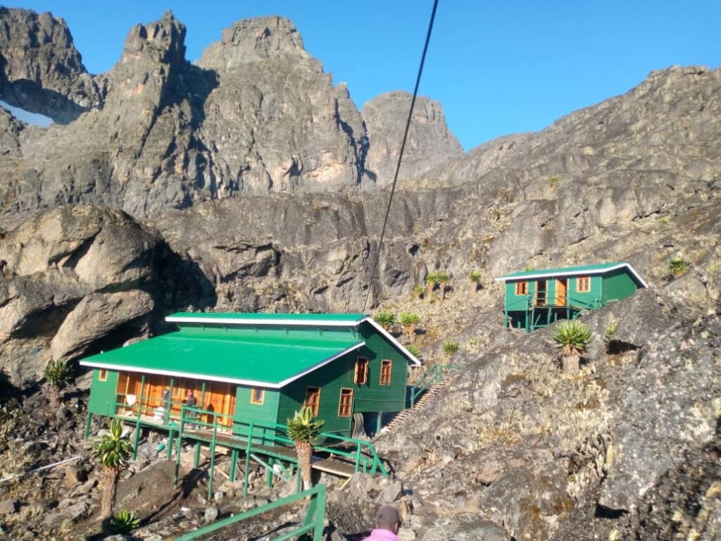
And yet the setting is extraordinary. The camp looks directly across a boulder-strewn alpine landscape toward the Stanley Plateau and the glaciers that still cling for now to the upper flanks of the highest Rwenzori peak. The retreat of these glaciers over the past century has been dramatic and measurable; they have lost more than 80% of their extent since 1906. Standing at Margherita Camp on a clear evening, watching the last equatorial glaciers of Africa catch the alpenglow, one feels both the extraordinary privilege of the moment and a pressing awareness of its fragility.
Summit attempts typically begin before dawn, usually between 4:00 and 5:00 AM, to reach the glacier crossing in the clearest, most stable conditions of the day. Our guides carry the fixed ropes, ice axes, and crampons needed for the glaciated upper section and have the experience to manage this technical terrain safely.
Margherita Peak: Africa’s Third-Highest Summit
Standing at 5,109 metres (16,762 feet), Margherita Peak is the highest point of Mount Stanley, the highest point of the Rwenzori range, the highest point of Uganda, and the third-highest summit on the African continent after Kilimanjaro and Mount Kenya. It was first summited on June 18, 1906, by the Duke of Abruzzi, Luigi Amedeo di Savoia, who named it after Queen Margherita of Italy. The Duke’s expedition also first climbed virtually every other major Rwenzori peak in what remains one of the most efficient high-altitude mountaineering achievements in African exploration history.
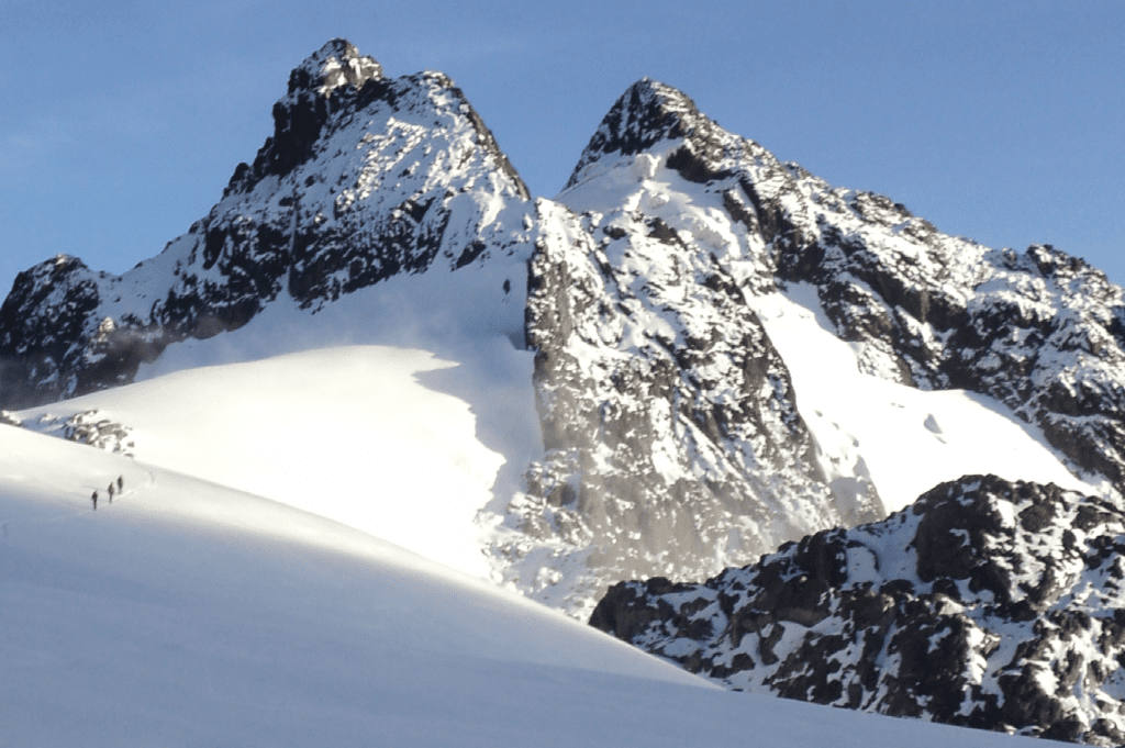
The final ascent to Margherita Peak from the Kilembe Trail involves crossing the Speke Glacier, one of the last remnant glaciers in equatorial Africa, and ascending steep, icy slopes that require basic mountaineering technique. This is not a scramble; it is genuine glacier mountaineering, though well within the capability of any trekker with reasonable fitness and the guidance of an experienced Rwenzori mountain guide. The use of crampons, an ice axe, and fixed lines is standard practice, and Rwenzori Trekking Safaris provides all technical equipment as part of the guided summit package.
The view from the summit on those clear mornings when the habitual cloud cover parts is one of the most remarkable in Africa. The Congolese rainforest stretches westward to the horizon. The Virunga volcanoes are sometimes visible to the south. The Alexandra and Albert peaks of Mount Stanley rise close at hand, their ice-coated flanks reflecting the early-morning sun with a brilliance that seems entirely out of place at this latitude. It is a summit that rewards every difficult step of the journey to reach it.
The Six Rwenzori Peaks Accessible via the Kilembe Trail
One of the defining strengths of the Kilembe Trail over the Central Circuit is the range of peaks it unlocks. Depending on the itinerary length chosen, trekkers on the Kilembe Trail can access six of the Rwenzori’s major summits.
Mount Stanley: Margherita Peak (5,109 m)
The highest and most celebrated of the Rwenzori peaks, Mount Stanley bears multiple summits, Margherita, Alexandra, and Albert, all on the same massif. The Kilembe Trail’s approach to Margherita is considered by many of our senior guides to offer the finest summit-day experience of any route in the range, partly because the Margherita Camp position gives trekkers the most intimate view of the Stanley Plateau glaciers before the final ascent.
Mount Speke: Vittorio Emanuele Peak (4,890 m)
The second-highest Rwenzori peak, Mount Speke, at 4,890 metres is accessible from the upper Kilembe Trail via the Scott Elliot Pass. Named after the Victorian explorer John Hanning Speke, who famously identified Lake Victoria as the source of the Nile, this peak offers a genuinely rewarding additional day for trekkers on longer itineraries. The standard route to Vittorio Emanuele, Speke’s highest point, involves a steep rocky ascent but no glacial crossing, making it the most technically accessible of the high Rwenzori summits.
Mount Baker: Edward Peak (4,843 m)
The massive, block-like form of Mount Baker dominates the eastern skyline from the upper Kilembe Trail. Baker’s highest point, Edward Peak at 4,843 metres, is reached via the Freshfield Pass and is included in several of our longer Kilembe-based itineraries, including the 10-day Rwenzori trek. Baker’s slopes are notably boggy in the lower sections and rocky in the upper, and the 360-degree view from Edward Peak across both the Ugandan plains and the Congolese forest is among the finest in the entire range.
Mount Luigi di Savoia: Weismann Peak (4,627 m) and Sella Peak
Named after the commander of the 1906 expedition, Mount Luigi di Savoia sits at the southern end of the Rwenzori massif and is accessible on extended Kilembe Trail routes. Weismann Peak, at 4,627 metres, is the highest point of this massif and is featured in our 6-day Weismann Peak itinerary. The approach via the Kilembe Trail passes through some of the most dramatic heather moorland in the range.
Mount Emin: Umberto Peak (4,798 m)
Named after the German-born governor of Equatoria, Eduard Schnitzer (known as Emin Pasha), Mount Emin is one of the lesser-climbed Rwenzori peaks but is included on ambitious extended itineraries that explore the northern sections of the range. Its inclusion via the Kilembe Trail typically requires an 8- to 10-day itinerary with acclimatisation built into the schedule. Our dedicated 7-day Mount Emin trek is the cleanest itinerary for those targeting this summit.
Mount Gessi: Bottego Peak (4,715 m)
The most remote of the major Rwenzori peaks, Mount Gessi sits at the northern extremity of the range and is reached via a challenging traverse across the high plateau. Our 7-day Mount Gessi trek uses the Kilembe approach to access Bottego Peak, and the complete 13-day six-peaks expedition, the ultimate Rwenzori challenge, links all six major summits in a single continuous traverse.
The Five Vegetation Zones: What You Will Walk Through
One of the most scientifically celebrated features of the Rwenzori Mountains is their extraordinary sequence of vegetation zones: five distinct plant communities stacked vertically from the park boundary to the glaciated peaks, each so radically different from the last that ascending the Kilembe Trail feels more like traveling between continents than climbing a single mountain. No other trekking route in Africa passes through this many biomes in such rapid succession.
Montane Rainforest (1,600–2,500 m)
The trail begins in the montane rainforest, a closed-canopy forest of Podocarpus, Symphonia, and Ficalhoa species draped in epiphytic mosses and ferns. The understory is dense with wild bananas, tree ferns, and a riot of climbing plants. The environment is warm, humid, insect-rich terrain, the forest where three-horned chameleons bask on low branches and the Rwenzori turaco calls from hidden perches overhead. The trail underfoot is root-tangled and often slippery, and morning rain is common at any time of year.
Bamboo and Heath Zone (2,500–3,200 m)
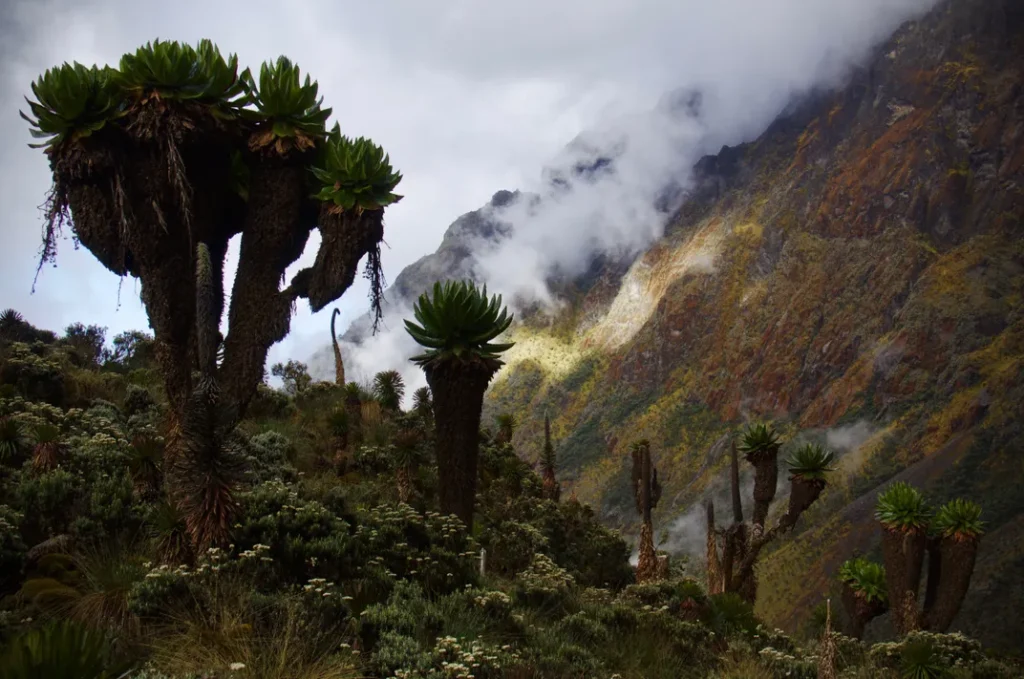
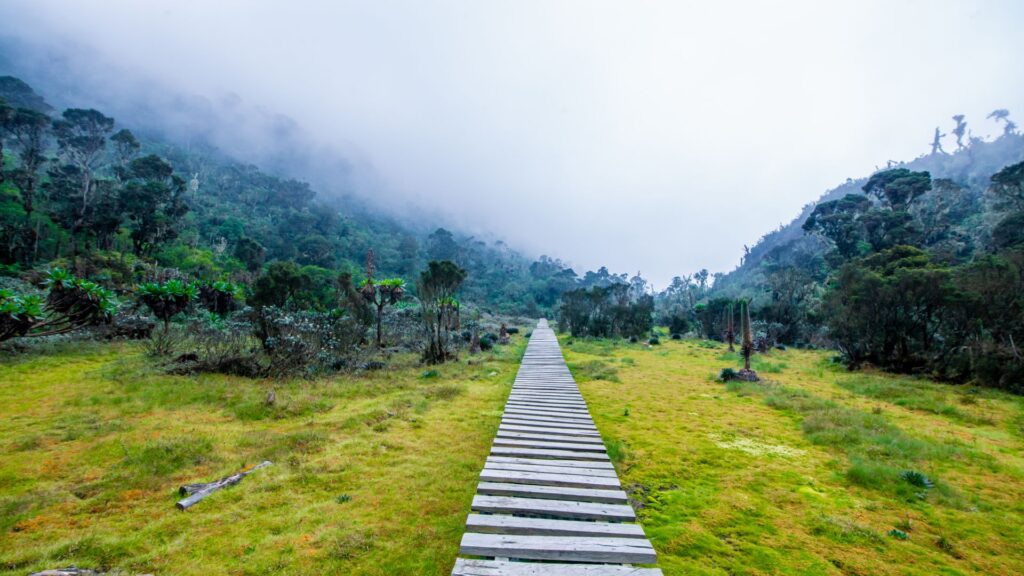
Above the rainforest, bamboo groves intersperse with the first giant heathers, Erica excelsa trees that can grow to fifteen metres and are so heavily draped in lichen that they seem more ghost than tree. The forest’s character shifts from tropical to a colder, more northern feel, yet it remains strange; there is no exact temperate equivalent for this vegetation. Mosses deepen underfoot, the trail grows boggier, and the temperature begins to drop noticeably after midday.
Heather and Moorland Zone (3,200–4,000 m)
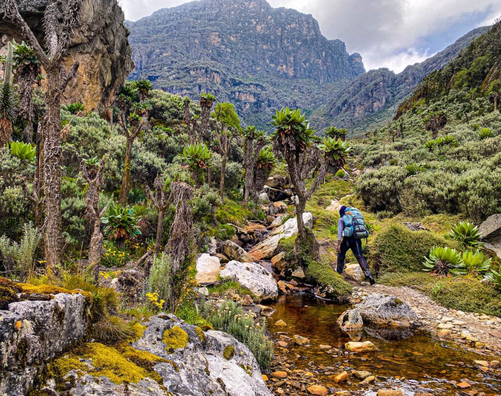
The giant heathers yield way to open moorland dominated by Alchemilla, tussock grass, and the first giant groundsels, Senecio rwenzoriensis, with their thick stems and terminal rosettes of leaves that look like something from a science fiction illustration. Giant lobelias (Lobelia wollastonii) emerge from the mist on boggy ground, reaching three metres in height. This area is the zone that most powerfully defines the visual identity of the Rwenzori high country, and most photographers find themselves stopping repeatedly on the trail between Kalalama and Mutinda.
Alpine Zone (4,000–4,500 m)
Above the moorland, the vegetation thins dramatically, and rocks, bogs, and isolated cushion plants dominate the landscape. The giant groundsels continue but become sparser and more gnarled. The trail here crosses several stream gullies and navigates rocky ridges where the wind is constant and the temperature can drop below freezing even in the afternoon. This is the zone around Bugata Camp and Margherita Camp, where the raw physicality of the altitude becomes the dominant experience.
Nival Zone (4,500m+)
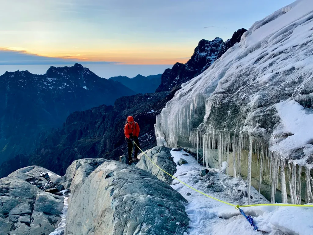
Above Margherita Camp, all vegetation ceases. The landscape is ice, rock, and snow, the domain of the glaciers that have clung to these peaks since the last ice age, though with diminishing tenacity as global temperatures rise. The summit zone is silent except for wind and crampons on ice. On a clear summit morning, the sunrise light on the glacier from the Stanley Plateau ranks among the most beautiful sights any mountaineer will ever witness.
Wildlife on the Kilembe Trail: What You Might See
The Kilembe Trail passes through wildlife habitat of exceptional quality and diversity. Rwenzori Mountains National Park protects over 70 mammal species and more than 217 bird species, many of them endemic to the Albertine Rift, one of Africa’s most biodiverse regions. While the Rwenzori is not a wildlife-watching destination in the savanna-game-drive sense, the animal life encountered on the Kilembe Trail is often startlingly intimate and uniquely Rwenzori.
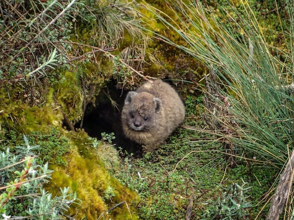
Among the mammals, the Rwenzori colobus monkey, a handsome black-and-white primate with dramatic flowing white fur, is frequently seen in the montane forest in the lower sections of the trail. You will regularly spot blue monkeys, L’Hoest’s monkeys, and bushbuck. The secretive forest hog, Africa’s largest wild pig, haunts the forest edges, and its presence is more often confirmed by the rootings in the path than by direct sightings. Higher up, in the heather and moorland zones, the Rwenzori otter shrew inhabits the mountain streams, though spotting it requires patience and a degree of luck.
For birders, the Kilembe Trail offers some of the best birding for Albertine Rift endemics in East Africa. The Rwenzori turaco is unmissable, its emerald, crimson, and blue plumage blazing against the dark forest. The handsome spurfowl, the Archer’s ground robin, the stripe-breasted tit, the Rwenzori batis, and the white-headed wood hoopoe all regularly appear on the trail. The Kilembe Trail, which passes through undisturbed old-growth forest, offers a significantly richer birding experience than the Central Circuit in the lower sections.
The Diamond Trail, a specialized primate route within the park, is the best option for chimpanzee sightings and can be combined with a Kilembe Trek in a comprehensive Rwenzori experience that takes in both the high peaks and the forest primates.
How Difficult Is the Kilembe Trail? Honest Assessment
The Kilembe Trail is, without qualification, a challenging trekking route. This is not a path that rewards casual preparation or can be completed comfortably by someone who walks the dog on weekends but rarely hikes in the hills. It demands sustained cardiovascular effort across multiple consecutive days, tolerance of cold, wet, and often miserable weather conditions, and the mental fortitude to keep moving when fatigue and altitude are working against you simultaneously. Our full difficulty assessment guide explores the topic in detail.
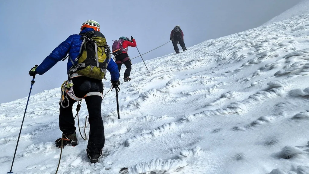
That said, it is emphatically not a technical mountaineering route for most of its length. Below Margherita Camp, the Kilembe Trail requires no ropes, harnesses, or climbing experience; only fitness, appropriate gear, and a willingness to keep moving in challenging terrain. The glacier crossing on the final summit push is the only section that requires technical mountain skills, and our guides manage this section entirely, providing all the necessary equipment and instruction.
Our fitness and training guide recommends that trekkers aiming for Margherita via the Kilembe Trail be able to comfortably complete 25–35 kilometer days on hilly terrain before departing, with consistent hill training in the three to four months before the expedition. Older trekkers and first-timers should read our specialist guides on these topics; both groups can successfully summit on the Kilembe Trail with the right preparation and pacing strategy. Our beginner’s guide to Rwenzori trekking addresses first-timer concerns honestly and in detail.
Kilembe Trail vs. Central Circuit Trail: Which Route Is Right for You?
The most common question trekkers planning a Rwenzori expedition ask is: which route should I choose?” Our dedicated comparison Central Circuit vs. Kilembe Trail explores the topic exhaustively, but the short version is this.
The Central Circuit Trail enters the park from the north at Nyakalengeji and loops through the core of the range in a circuit that passes through the major high camps of Nyabitaba, John Matte, Bujuku, and Elena in a logical sequence. It is the older, better-established route, with a longer track record, slightly more predictable trail conditions in the mid-sections, and a trailhead that is arguably easier to access from Kampala by road. It is also busier during peak season.
The Kilembe Trail comes in from the south and gives a very different experience of the mountain: more varied forest on the lower trail, a different sequence of vegetation zones, a stronger sense of historical and cultural context through the Kilembe mining heritage, and the distinctive Nyamwamba valley corridor that is exclusive to this route. It tends to feel less crowded and more exploratory, and the camp positioning provides slightly better acclimatisation profiles for shorter itineraries.
For trekkers who want to summit Margherita Peak and have 7–8 days, either route delivers. The Kilembe Trail offers the deepest, most varied, and most immersive Rwenzori experience, making it the more rewarding journey, according to our guides’ honest assessment.
For those who truly want the best of both, we offer several itineraries that use the Kilembe Trail for ascent and the Central Circuit for descent or vice versa, creating a full traverse of the range that experiences both trail systems in a single expedition. The 13-day six-peaks expedition and the 18-day all-eight-peaks traverse both follow this combined approach.
Best Time to Trek the Kilembe Trail
The Kilembe Trail is open year-round, but the experience varies significantly with the season. Our comprehensive guide to the best time to visit the Rwenzoris covers this topic in full detail, but the key points for planning the Kilembe Trail are as follows.

The two primary dry seasons, December through February and June through August, offer the best summit conditions. During these windows, the trail is drier underfoot (though ‘dry’ is a relative term in the Rwenzori, where annual rainfall exceeds 3,000mm on the upper slopes), the risk of the serious bog crossings being impassable is lower, and the glaciated upper sections are in better condition for safe traversal. Visibility is best during these months, providing the clearest summit views.
The wet seasons, March through May and September through November, are wetter, muddier, and cloudier, but they have their own significant appeal. The waterfalls on the lower Kilembe Trail are at their most spectacular in the wet season, carrying enormous volumes of water off the saturated upper mountain. The forest vegetation is at its most verdant and biologically active. Trekker numbers drop substantially, creating a more private, wilderness-feeling experience. And the reduced demand means more flexibility on departure dates.
The truly honest advice is this: the Kilembe Trail is never easy. Even in the ‘dry’ season you should expect multiple wet days, the possibility of snow on the upper mountain, and trail conditions that will challenge your footwear and your patience. The difference between seasons is one of degree, not of kind. The right gear, above all, the right boots, matters enormously regardless of when you travel.
What to Pack for the Kilembe Trail: Essential Gear Guide
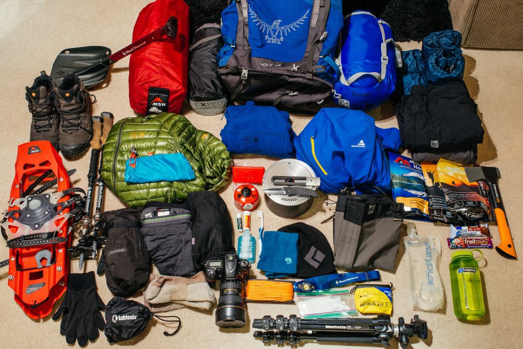
The Rwenzori has a well-earned reputation for destroying under-prepared trekkers and their equipment. The combination of persistent moisture, extreme temperature swings (from tropical forest heat at 1,600m to well-below-freezing nights above 4,000m), and terrain that subjects boots, gaiters, and trousers to hours of bog-walking creates demands that most general-purpose hiking gear is not built to meet. Our full packing list for Rwenzori trekking is the authoritative resource on this subject, but the key principles for the Kilembe Trail are worth summarizing here.
Footwear is the single most important equipment decision you will make for the Kilembe Trail. Experienced Rwenzori guides are unequivocal on this point: the rubber wellington boot specifically the neoprene-lined, high-sided bog boot, is the appropriate footwear for the middle and upper sections of the trail, where bog crossings make waterproof leather hiking boots essentially irrelevant within the first two hours. Our dedicated boots guide explains in detail which specific types to acquire and how to fit them correctly before you depart.
Our layering and warmth guide covers the critical importance of technical base layers, mid-layers, and shell garments in a mountain environment where getting wet and cold simultaneously is not a theoretical possibility but a near-daily certainty on longer treks. A quality down jacket, waterproof trousers, warm gloves, and a lined balaclava are not optional extras; they are essential pieces of safety equipment above 3,500 metres.
Health, Altitude, and Safety on the Kilembe Trail
The Kilembe Trail’s maximum elevation of 5,109 metres at Margherita Peak places it firmly in the category of high-altitude mountaineering, where altitude sickness is a genuine and potentially serious risk. Our complete medical guide to Rwenzori trekking and our dedicated acclimatisation strategy guide are essential reading before any summit expedition. The Kilembe Trail’s camp structure, with its gradual altitude progression and well-positioned rest camps, is one of the better-designed acclimatisation profiles of any Rwenzori route when the itinerary is properly paced.
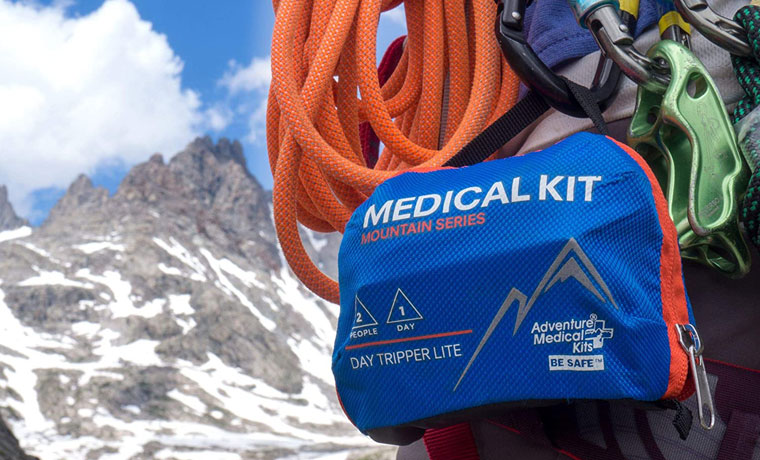
Acute Mountain Sickness (AMS) affects a proportion of trekkers on any high-altitude route. Symptom headaches, nausea, fatigue, and dizziness typically emerge between 2,500 and 4,000 metres and can be managed with adequate rest, hydration, and the ‘climb high, sleep low’ principle that the Kilembe Trail incorporates into its camp structure. More serious forms, High Altitude Pulmonary Edema (HAPE) and High Altitude Cerebral Edema (HACE), are rare but life-threatening and require immediate descent. Our guides are trained in altitude medicine recognition and are equipped to initiate emergency descent procedures when needed.
The safety record of Rwenzori trekking is, in the context of the altitude and terrain involved, genuinely good. The mandatory guide system, the well-established camp infrastructure, and the trailhead’s proximity to Kasese (with medical facilities accessible within a few hours’ drive) allow for faster emergency response than on many comparable African mountain routes. We strongly recommend comprehensive travel insurance that explicitly covers high-altitude trekking and helicopter evacuation, a policy detail that many standard travel insurance products omit.
Cost of Trekking the Kilembe Trail: What to Budget
The full cost of a Kilembe Trail expedition depends on itinerary length, group size, and the services included. Our complete cost breakdown for 2026 covers every line item in detail, but the main components for any Kilembe Trail package are Uganda Wildlife Authority park fees and permits, Rwenzori Trekking Services trail fees, guide and porter wages, mountain camp accommodation, and equipment hire. For the 8-day summit itinerary, our most popular Kilembe Trail package, the all-in cost per person ranges from approximately $1,400–$2,200 USD depending on group size, with solo trekkers paying the higher end of the range.
Tipping for guides and porters is standard practice and an important part of the trekking economy that sustains the Bakonzo mountain communities whose members staff every expedition. Our porter services and tipping guide explain the accepted tipping norms and how to calculate a fair and respectful gratuity for the team. A budget of approximately $150–$300 per person for tips (depending on trek duration and team size) is appropriate for most Kilembe Trail expeditions.
Getting to the Kilembe Trailhead: Travel Logistics
The Kilembe Trail begins at the park gate in Kilembe, approximately 12 kilometers from Kasese town in Kasese District. Kasese serves as the primary gateway town for Kilembe Trail expeditions, and our Kasese travel guide for trekkers covers it in detail. The town is approximately 420 kilometers from Kampala by road, a drive of five to six hours, and is well-connected by daily coach services (PostBus, Gateway, and Link Bus services all operate this route). Kampala’s Entebbe International Airport is the primary international entry point, and our complete travel and transport guide covers all options from Entebbe to Kilembe, including private transfers, shared taxis, and the bus schedule.
Many trekkers combine their Kilembe Trail expedition with other Uganda experiences, taking advantage of the western Uganda circuit that links the Rwenzoris with Queen Elizabeth National Park (approximately 1.5 hours from Kasese), Bwindi Impenetrable Forest and gorilla trekking, and chimpanzee trekking in Kibale Forest. Our combination safari packages make this kind of comprehensive Uganda itinerary straightforward to plan and execute.