The Rwenzori Central Circuit Trail: The Definitive Expert Guide to Uganda's Greatest Mountain Trek
The definitive guide to the Rwenzori Central Circuit Trail route stages, huts, peaks, difficulty & best time. Plan your Uganda trek. Trek the legendary Central Circuit Trail in the Rwenzori Mountains. Learn about the route, daily stages, huts, climbing peaks, and the best itineraries for your adventure.
Explore the legendary Rwenzori Central Circuit Trail, Uganda’s premier route to Margherita Peak, Mount Stanley, Baker & Speke. Cross glacial valleys, bog boardwalks, and alpine zones on an epic mountaineering safari. Climb the breathtaking Rwenzori Central Circuit Trail, a world-famous climbing route that winds its way across Uganda’s “Mountains of the Moon.” Beginning at 1,651 meters at Mihunga Gate, this classic trail winds its way through verdant montane forest, bizarre bog landscapes, ice passageways, and breathtaking alpine zones.
At its peak, at 5,109 meters, Margherita Peak is the third-highest mountain in Africa. Climbing it is an optional final step. Climbers and ecotourists have made the Central Circuit their sacred pilgrimage for generations. The community-owned Rwenzori Mountaineering Services (RMS) maintains this trail. To the summits of Mount Stanley, Mount Baker, and Mount Speke, it is the quickest and most direct route.
Margherita Peak may once again be safely trekked to with the help of the new glacier bridge and support ropes installed by the Uganda Wildlife Authority. This improvement has made reaching this high-altitude destination easier and safer than before. Hikers will stay in charming mountain lodges every seven to ten days, depending on their schedule. From the forest-rich Nyabitaba Hut to the glacier-kissed Elena Hut, the route offers the ideal blend of rugged wilderness, mountaineering adventure, and cultural immersion.
The Route That Defines the Mountains of the Moon
Few mountain routes in Africa carry the accumulated weight of history, ecological wonder, and raw alpine challenge that the Rwenzori Central Circuit Trail does. This is not a trek you stumble across. Those who arrive at the Nyabisindu Gate at the edge of Rwenzori Mountains National Park have already made a decision that separates them from the casual tourist; they are here to enter one of the last great wilderness experiences left on the African continent. They have come to walk through fog-drenched montane forests alive with L’Hoest monkeys, to cross the extraordinary Bigo Bogs on elevated boardwalks, to press through dense heather forests draped in ancient moss, and to stand, if the mountain wills it, on Margherita Peak at 5,109 metres, the third highest point in all of Africa.
The Central Circuit is the oldest, most complete, and most celebrated trekking route through the Rwenzori Mountains, also known as the Mountains of the Moon, a UNESCO World Heritage Site straddling the border between Uganda and the Democratic Republic of Congo. It is managed by the community-owned Rwenzori Mountaineering Services (RMS), operating under the Uganda Wildlife Authority, and has been the primary artery of guided expeditions through these peaks for decades. Whether your itinerary is six days or thirteen, whether your goal is Margherita Peak alone or all six major summits, the Central Circuit is the route through which the Rwenzori’s greatest secrets are revealed.
This guide is the most comprehensive resource available on the Rwenzori Central Circuit Trail. It covers the route’s ecology, geological origins, history, terrain, daily stages, acclimatization, gear requirements, best seasons, costs, and the practical logistics of reaching the trailhead. Read it carefully, and you will arrive at the gate with the knowledge of someone who has already walked every meter of this trail.
What Is the Rwenzori Central Circuit Trail?
The Central Circuit Trail is a circular trekking route that winds through the inner heart of Rwenzori Mountains National Park. Starting and ending at the Nyabisindu Trailhead (also called the Nyakalengija or Mihunga entrance at 1,651 metres), the route traverses some of the most dramatic mountain terrain in equatorial Africa. The trail covers approximately 55–60 kilometers in total, slightly longer if dedicated summit days are included for peaks beyond Margherita, and gains and loses substantial elevation across each of its daily stages.
What makes the route a ‘circuit’ in the truest sense is its looping nature: trekkers do not retrace their steps but instead move in a broad arc around the central massif, passing through different valleys, crossing high alpine passes, and descending via separate ridgelines. This means the landscapes shift fundamentally from one day to the next: the dripping cathedral forest of day one bears no resemblance to the alien heather moors of day three, and neither environment prepares you for the glacial silence of the Elena Hut zone above 4,500 metres.
From the mid-twentieth century onward, the trail progressively took shape, though pioneering expeditions in the early 1900s laid its foundations. Today, it remains the single most direct route to Mount Stanley, Mount Speke, and Mount Baker, three of the six major massifs that define the Rwenzori range, and it serves as the essential backbone for every serious Rwenzori mountaineering expedition. All three of the other main routes into the high Rwenzori, the Kilembe Trail, the Bukurungu Trail, and the Diamond Trail, are measured and understood in relation to the Central Circuit’s established course.
The Rwenzori Mountains: An Exceptional Stage for an Exceptional Trek
Before walking the Central Circuit, it is worth understanding deeply what makes the Rwenzori Mountains unlike any other mountain range on the continent or indeed anywhere in the world. These are not volcanic peaks thrust upward by magma, as Kilimanjaro and Mount Kenya are. They are block mountains formed by tectonic uplift along the western arm of the East African Rift Valley, built from ancient Precambrian crystalline basement rocks exposed by hundreds of millions of years of geological movement and subsequent deep erosion. Their structural origin imparts them a fundamentally different character from their volcanic neighbors: heavily dissected valleys, complex ridgeline topography, and a persistent, almost geological damp that keeps the high mountains perpetually shrouded in cloud and mist.
The Rwenzori range stretches approximately 120 kilometers in length and 50 kilometers in width across the Uganda-DRC border. Six major massifs rise above 4,500 metres, and three of these retain permanent ice and snow. Mount Stanley, the highest at 5,109 metres, hosts the last remaining equatorial glaciers in Uganda. The range receives more rainfall than almost any other mountain system on the continent, an annual average of over 2,000 millimeters at the mid-altitude zones and considerably more in the high cirques, which explains both the bewildering botanical richness of its vegetation zones and its well-earned reputation for mud, mist, and startlingly unpredictable weather.
Its biodiversity is exceptional and largely unique to the Albertine Rift: the broader region in which the Rwenzori sits is recognized as one of Africa’s most important biodiversity hotspots, and the mountains themselves support species found nowhere else on Earth. UNESCO recognized the Rwenzori Mountains National Park as a World Heritage Site in 1994, and the mountains have been on the UNESCO World Heritage List ever since, being one of only a handful of African mountain parks to receive this designation.
For anyone seriously considering the Rwenzori versus other African mountains, the detailed comparison in Rwenzori vs. Kilimanjaro clarifies the key differences in difficulty, experience, and what each mountain offers. In summary, the Rwenzori is wetter, wilder, ecologically richer, and, in most trekkers’ experience, considerably harder than any standard Kilimanjaro route.
The History of the Central Circuit Trail and Its Pioneering Explorers
The history of the Rwenzori Mountains as a subject of global exploration is long, dramatic, and rooted in one of geography’s most enduring mysteries. The ancient Alexandrian geographer Claudius Ptolemy wrote in the second century AD of the “Mountains of the Moon,” a legendary snow-capped range at the equator whose meltwaters fed the Nile. For nearly eighteen centuries, the range remained a tantalizing geographical myth. It was Henry Morton Stanley, returning from his remarkable trans-Africa journey in 1888, who caught a brief glimpse through parting clouds of the gleaming summits and confirmed to a skeptical Western world that Ptolemy’s mountains were real.
The definitive era of Rwenzori exploration arrived in 1906, when Luigi Amedeo, the Duke of Abruzzi, led a superbly organized Italian mountaineering expedition that achieved the first ascents of all six major massifs in a single season. On June 18th, 1906, the Duke’s party stood atop the highest point of Mount Stanley, which he named Margherita Peak in honor of the Queen of Italy, completing the first ascent of the third-highest mountain in Africa. The route his team pioneered through the range provided the conceptual and physical framework for what eventually became the modern Central Circuit.
The trail as a managed trekking route developed progressively through the mid-twentieth century. By the 1950s and 1960s, a series of basic mountain huts had been established at key points along what would become the Circuit, and regular scientific, mountaineering, and recreational expeditions began using the corridor consistently. The formation of Rwenzori Mountaineering Services as the primary concessionaire for the Central Circuit, a community-owned organization employing hundreds of Bakonzo guides, porters, and hut staff, completed the transformation from explorer’s route to established trekking trail.
The past two decades have seen significant improvements. The hut network has been upgraded, the bog boardwalks installed and extended, and most recently the Uganda Wildlife Authority invested in the glacier bridge and fixed rope system that reopened the Margherita Peak summit route following a period when the changing glacier topography had made the crossing dangerously complex. The Central Circuit is today a fully functional, if wonderfully demanding, mountain trekking route with infrastructure calibrated for the sustained comfort of guided international expeditions.
Attractions along the Rwenzori Central Circuit Trail include:
The Central Circuit is a lovely refuge for unique and native animals, along with its rugged terrain and high altitude. Hikers in the lower areas may spot L’Hoest monkeys, black-and-white colobus monkeys, and perhaps even the elusive forest elephants. The trees up there are home to lovely birds like the Rwenzori turaco, the quirky weaver, and the charming francolin.
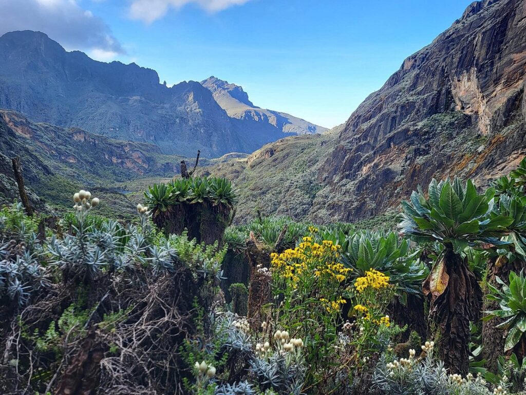
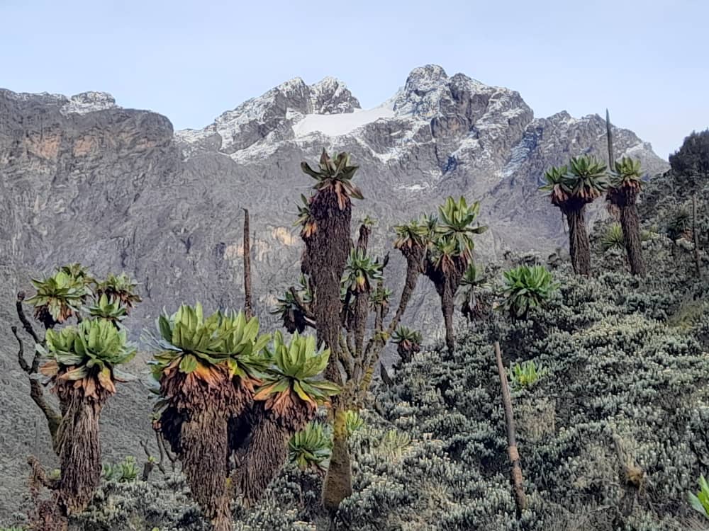
And then the plants! The enormous lobelias, intriguing groundsel forests, and lush carpets of moss create an alpine area that feels like it’s straight out of a Tolkien book rather than tropical Africa.
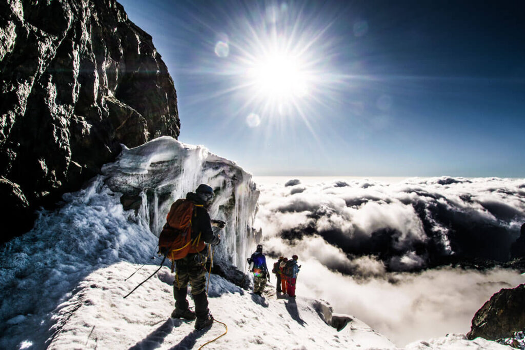
The hike to Margherita Peak began again after a short break to make it safer. It was built by the Uganda Wildlife Authority (UWA) to cross a crevasse on the Margherita Glacier. It also has new fixed climbing lines. This ensures that hikers can safely reach the summit.
With this important change, the trail is once again safe for hikers, and they can now reach one of Africa’s few remaining equatorial glaciers. Climate change has significantly altered the ice cover, yet the journey to Margherita remains both beautiful and enjoyable.
Five Vegetation Zones: Walking Through Stacked Worlds
One of the Central Circuit’s most profound features is its passage through dramatically distinct ecosystems within a relatively compact vertical range. The Rwenzori’s vegetation zones are not gradual transitions but stacked worlds, each with its atmosphere, dominant species, ecological logic, and emotional register. Moving upward through them is one of the most remarkable ecological journeys available anywhere in African trekking.
The Montane Forest Zone (1,650 m – 2,500 m)
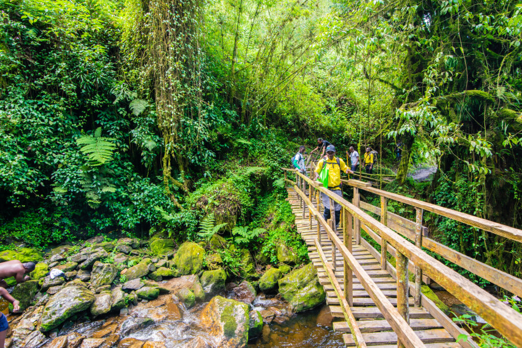
The Central Circuit begins in the montane forest zone, which extends from the park gate at approximately 1,650 metres to around 2,500 metres elevation. The environment is dense, humid, and magnificently alive: a cathedral architecture of hardwood trees draped in long pendants of moss and lichen, where the resonant calls of Rwenzori turacos cut through the morning fog, and colobus monkeys move across the canopy with casual authority. The understory is thick with giant ferns, wild impatiens blazing pink and orange against the shadows, and the massive root buttresses of ancient trees that have anchored themselves into this volcanic soil for centuries. The trail in this zone is steep and rooted, frequently slippery, and densely vegetated on both sides; it demands attentiveness and careful footwork from the first hour.
The Bamboo and Heather Zones (2,500 m – 3,500 m)
Above the montane forest, bamboo appears briefly on some exposed aspects before yielding to the tree heather zone, which extends from roughly 2,500 to 3,500 metres. Here, Erica arborea and related species grow to remarkable heights — ten metres and beyond; their trunks are gnarled and contorted, wrapped entirely in thick, living carpets of sphagnum moss that drip water constantly regardless of whether rain is falling. Walking through the heather forest has a quality that every trekker notices independently: the light is soft and filtered, the silence between bird calls is absolute, and the sense of profound biological age is overwhelming. These trees were old when most living trekkers were born.
The Bigo Bogs (3,000 m – 3,800 m)
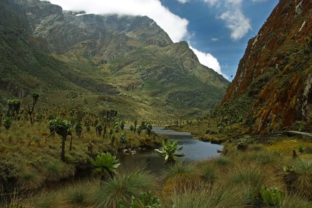
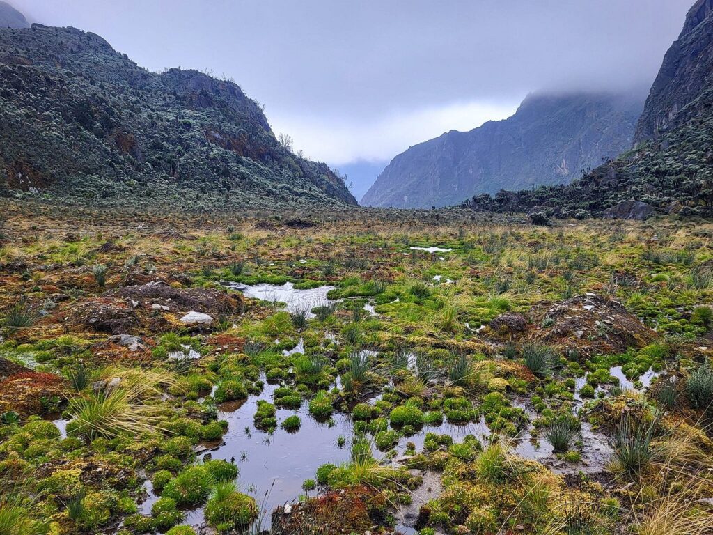
Occupying the broad valley floors of the Mubuku and Bujuku valleys in the transition between the heather and afro-alpine zones, the Bigo Bogs are among the most celebrated and most notorious features of the entire Central Circuit. These extensive peatlands are the product of tens of thousands of years of slow decomposition in a waterlogged, cold, high-altitude environment, and before the installation of elevated wooden boardwalks, they were the most genuinely hazardous section of the trail, with trekkers sinking to their waists in cold black peat being a not-uncommon experience. The boardwalks installed by RMS have made traversal both safer and faster, though the bogs’ character remains entirely primeval. In the early morning mist, with giant lobelias emerging from the fog on either side of the raised walkway and nothing but the sound of water and birds, the Bigo Bogs are one of the most remarkable atmospheric experiences in African mountain trekking.
The Afro-Alpine Zone (3,500 m – 4,500 m)
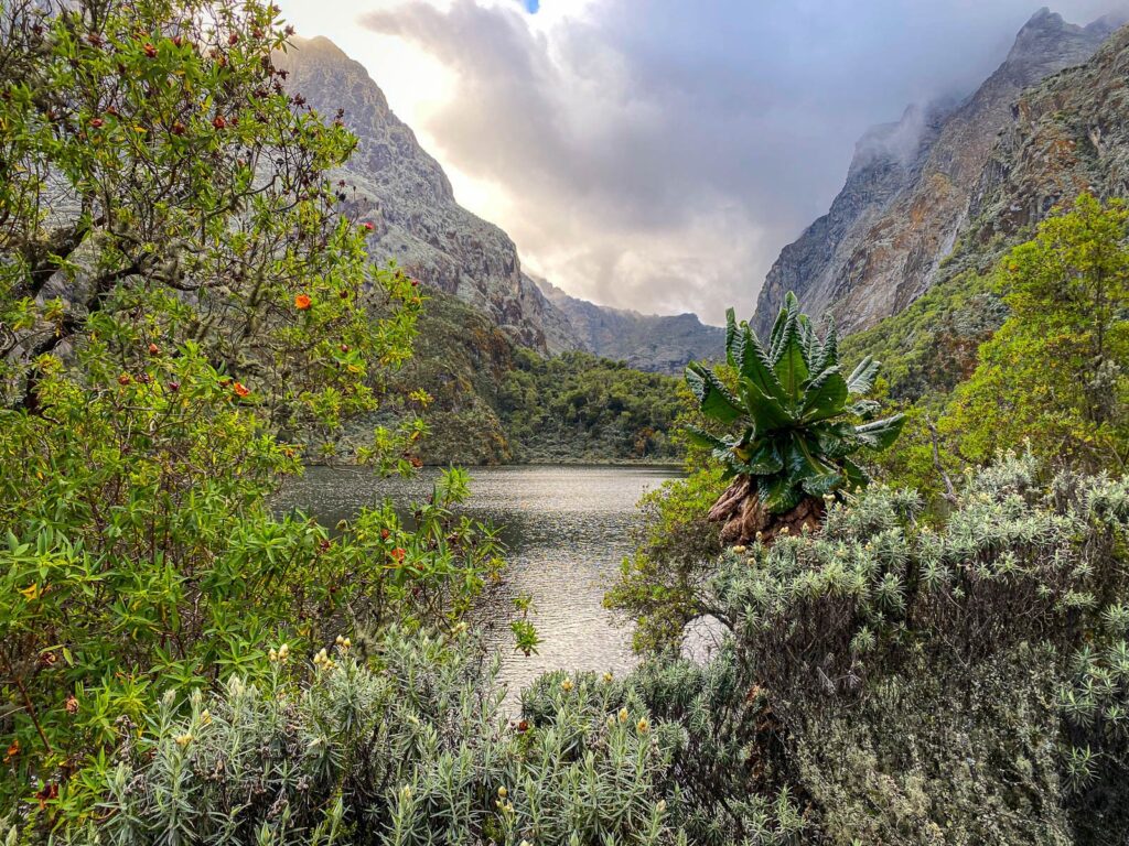
This region is the botanical heart of the Rwenzori’s global fame. Between roughly 3,500 and 4,500 metres, the giant lobelias and giant groundsels for which the Rwenzori is best known reach their full extraordinary expression. Lobelia wollastonii and Lobelia bequaertii develop tall, spike-crowned columns up to four metres high, with their rosettes closing at night to protect their cores from freezing temperatures. Senecio adnivalis, the giant groundsel, grows in dense stands with unbranched trunks topped by enormous rosettes of silver-green leaves, each plant resembling an oversized cabbage on a wooden post. These plants exist in these gigantic forms because of a combination of intense ultraviolet radiation, large daily temperature swings, and the unique high-altitude equatorial environment. Walking through a dense groundsel forest in morning mist, the silence broken only by the creak of stems and the distant call of a Rwenzori turaco, is an experience that resists straightforward description.
The Nival Zone (4,500 m and above)
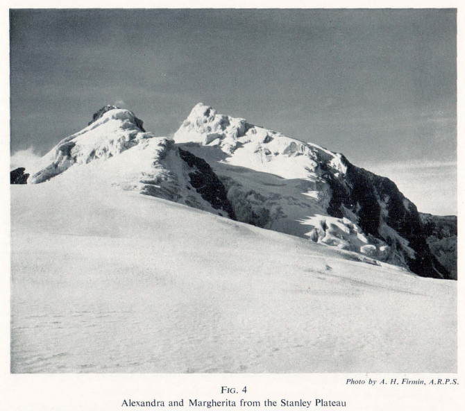
Above 4,500 metres, vegetation becomes increasingly sparse as rock, snow, and ice take over. The glaciers of the Rwenzori, now dramatically reduced from their historical extent, form the final ecological zone through which the summit route of the Central Circuit passes. Snow begins appearing reliably above about 4,800 metres, and from Elena Hut upward, the terrain is wholly glacial: crevassed ice, exposed rock ridges, and the unimpeded sky of the high tropics. The permanent snow of Margherita Peak, shared by Mount Stanley’s three highest points, is one of Africa’s rarest and most endangered natural phenomena.
Wildlife of the Central Circuit: The Albertine Rift’s Hidden Treasures
The Central Circuit does not offer the dramatic, predator-rich theater of the East African savanna, but for wildlife enthusiasts, it delivers experiences that are both rarer and, in many ways, more remarkable. The Rwenzori’s wildlife is overwhelmingly endemic: the Albertine Rift, the broader biogeographical zone in which these mountains sit, has the highest density of endemic vertebrate species of any region in mainland Africa, and the Rwenzori’s relative isolation, altitude range, and perpetual cloud cover have made it a refuge for species found nowhere else.
In the lower montane forest, L’Hoest’s monkeys (Allochrocebus lhoestii) are among the most reliably encountered primates, often visible near Nyabitaba Hut in the late afternoon. The black-and-white colobus (Colobus guereza) moves through the upper forest canopy in troops, its dramatic black-and-white fur conspicuous against the green. Forest elephants use corridors through the lower park, and their trails, which are massive root-torn channels through the undergrowth, are visible near the lower valley floor, though actual sightings require patience and fortune.
The Rwenzori turaco (Ruwenzorornis johnstoni) is the park’s most celebrated avian resident: a stunning bird combining deep crimson, purple, and iridescent green plumage, whose loud, distinctive call echoes through the forest from first light. The Handsome Francolin, Rwenzori Batis, and several sunbird species, including the Regal Sunbird, are regularly encountered throughout the heather zone, while the high-altitude alpine zone above 4,000 metres supports species such as the Alpine Chat and occasional high-flying raptors. For dedicated birders, the Rwenzori’s checklist of Albertine Rift endemics is one of the most compelling draws the mountains offer.
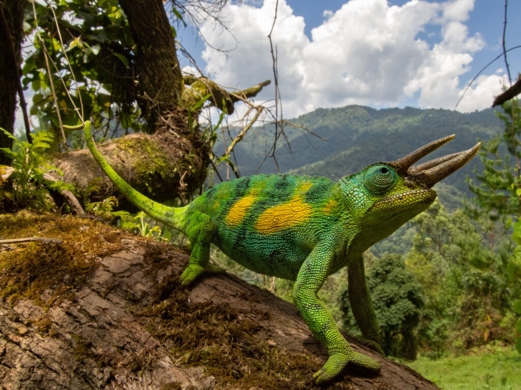
Three-horned chameleons, Trioceros johnstoni, are frequently found in the forest zone, their extraordinary ability to change color and their unhurried, measured locomotion making them one of the most memorable wildlife encounters of the lower trail. At night in the forest huts, Rwenzori red duikers sometimes move near the hut perimeters, and the sounds of the forest insects, frogs, birds, and the occasional crash of a larger mammal moving in the darkness provide a richly atmospheric backdrop to evening camp life.
Why the Central Circuit Still Reigns Supreme
What makes the Central Circuit Trail the preferred route for most hikers?
It’s the most established and traditional route with decades of trekking heritage.
Access to multiple peaks, including Mount Stanley, Mount Baker, and Mount Speke.
Rich biodiversity, including rare birds, mammals, and high-altitude flora.
Diverse landscapes ranging from tropical rainforests to glacial valleys.
Boardwalk-supported bogs, especially in the Bigo Bogs area, make the trek more manageable and less muddy.
Overnight huts spaced for ideal acclimatization and comfort.
Whether you’re a first-time trekker or a seasoned mountaineer, this circuit is your best shot at experiencing the full range of the Rwenzoris, both physically and spiritually.
The Major Peaks Accessible via the Central Circuit
The Central Circuit’s primary distinction among all Rwenzori routes is its direct access to three of the six major massifs, and with extensions, to all six. Understanding each peak’s character and summit requirements is essential for anyone planning a multi-peak expedition.
Mount Stanley (5,109 m): Margherita, Alexandra, and Albert Peaks
Mount Stanley is the highest peak in Uganda and the third highest in Africa. Its summit complex includes three major points: Margherita Peak (5,109m), Alexandra Peak (5,091m), and Albert Peak (5,087m), all permanently glaciated. The summit of Margherita Peak is the defining objective of most Central Circuit expeditions, reached via the Elena Glacier on the mountain’s northeastern flank. The Margherita Peak summit approach from Elena Hut at 4,541 m involves glacier travel across the Stanley Plateau, crossing the glacier bridge installed by the Uganda Wildlife Authority, and ascending the final rocky-ice ridge to the summit point. Ice axes, crampons, and rope management are required.
Mount Speke 4,890 m: Vittorio Emanuele Peak
Mount Speke is the second-highest Rwenzori massif and among the most frequently attempted secondary peaks on multi-day expeditions. From the Bujuku Valley on the circuit’s central section, climbers reach its summit, Vittorio Emanuele Peak. The climbing route is technically less demanding than the Margherita approach, but it still requires solid scrambling ability and comfort on exposed terrain. The 5-day Mount Speke trek and the 9-day three-peaks expedition both include Speke alongside Margherita.
Mount Baker 4,843 m: Edward Peak
Mount Baker stands between Mount Stanley and the Bujuku Valley, its summit, Edward Peak, accessible via the Scott Elliot Pass (4,372m) or the Freshfield Pass approaches. Baker is included in both the 9-day three-peaks expedition and the 13-day six-peaks grand expedition. Its summit is a strong mountaineering objective in its own right, combining technical challenge with some of the finest ridge views in the entire range.
Mount Emin, Mount Gessi, and Mount Luigi di Savoia
The three remaining major massifs, Mount Emin (4,798m), Mount Gessi (4,715m), and Mount Luigi di Savoia (4,627m), require significant route extensions beyond the standard Central Circuit loop and are typically included in the 13-day and 18-day grand expeditions. Each offers a distinct mountaineering challenge and the deep satisfaction of completing what amounts to a full traverse of the Rwenzori’s highest terrain.
The Mountain Huts of the Central Circuit
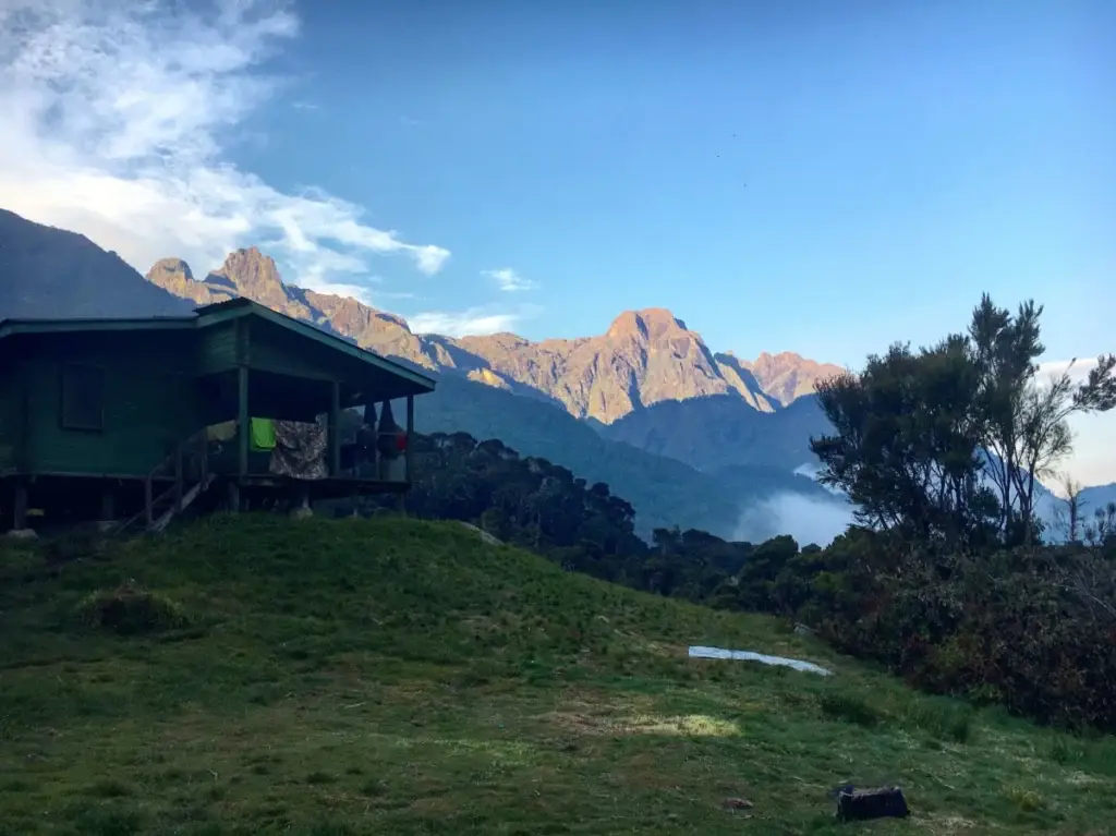
One of the Central Circuit’s most practical advantages over other high-altitude routes in East Africa is its network of established mountain huts managed by Rwenzori Mountaineering Services. These stone-and-timber structures provide bunk accommodation, basic cooking facilities, and reliable emergency shelter at every overnight stage, eliminating the need for tent-camping equipment and allowing porter loads and therefore trek logistics to be managed more efficiently.
Nyabitaba Hut (2,652 m) is the first overnight stop and the most accessible hut on the circuit; it can be reached in a single day from the gate and serves as the endpoint for introductory day hikes as well as the launching point for all multi-day circuits. Situated on a ridge overlooking the Mubuku Valley, it offers panoramic forest views and is large enough to accommodate substantial expedition groups.
John Matte Hut (3,414 m) marks the transition from the lower forest to the upper mountain zones. Located in the broad upper Mubuku Valley, surrounded by heather and high-altitude meadow, it is the critical acclimatization stop at which the seven-day itinerary deliberately slows pace to allow the body to adjust to the altitude before pushing higher.
Bigo Hut (3,996 m) serves as an intermediate shelter between John Matte and Bujuku, particularly useful for longer itineraries that build additional acclimatization days into the middle section of the circuit. Bujuku Hut (3,962m) sits at the edge of Lake Bujuku, one of the circuit’s most significant landmarks, with the three surrounding peaks rising above it in a remarkable natural amphitheater.
Elena Hut (4,541 m) is the highest accommodation on the circuit and the launch point for the Margherita Peak summit attempt. Its exposed position means nights here are reliably cold, often below freezing, and the morning start for the summit, typically 3:00–4:00 AM, takes place in darkness with headlamps and crampons. Guy Yeoman Hut (3,261m), on the descent side of the circuit via the Kitandara Valley and Freshfield Pass, serves as the final night stop before the return to Nyabitaba and the gate.
The Rwenzori Central Circuit: Stage by Stage
Understanding the daily stages of the Central Circuit in full detail is the foundation of effective planning. The route described here follows the standard seven-day schedule, the most popular and best-balanced itinerary with notes on shorter and extended variants where relevant.
Day 1: Nyabisindu Gate (1,651m) to Nyabitaba Hut (2,652m)
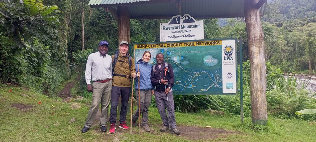
The trek begins at the Nyabisindu Trailhead, where park permits are checked and porter assignments are confirmed, and for most trekkers the reality of what lies ahead becomes briefly, viscerally clear. The first day’s walk ascends through the montane forest zone, crossing the Mubuku River on a metal bridge before climbing steadily through increasingly dense vegetation to Nyabitaba Hut at 2,652 metres. The ascent covers approximately 10 kilometers and gains around 1,000 metres, typically taking four to five hours at a measured pace. The forest here is magnificent and initially somewhat disorienting in its density, and the first day functions as a gradual introduction to the Central Circuit’s fundamental character: steep, rooted, wet, and spectacularly beautiful. For those wanting to sample this section before committing to the full circuit, a 1-day introductory trek to Nyabitaba is available.
Day 2: Nyabitaba Hut (2,652 m) to John Matte Hut (3,414 m)
The second day is one of the most demanding on the entire circuit. From Nyabitaba, the trail descends sharply into the Mubuku river gorge before crossing the Kurt Schafer Bridge over a thundering waterfall, one of the circuit’s memorable engineering moments, and then climbs relentlessly through upper bamboo and early heather forest toward John Matte Hut. The day covers approximately 9 kilometers with around 800 metres of net elevation gain and typically requires five to seven hours. On this day, trekkers begin encountering the tree heathers in earnest, and the botanical character that makes the Rwenzori’s middle altitudes so distinctive, the moss-wrapped trunks, the dripping silence, and the extraordinary scale of the plant life assert themselves fully.
Day 3: John Matte Hut (3,414 m) to Bujuku Hut (3,962 m)
Day three is the legendary bog day. The route crosses the Bigo Bogs on the elevated wooden boardwalks that have transformed this section from a near-impassable mud ordeal to a walkable if still remarkably atmospheric crossing. The boardwalks extend across the upper Mubuku Valley floor and into the lower Bujuku Valley, passing through the heart of the high lobelia and groundsel zone where the afro-alpine vegetation is at its most dramatic. After crossing the bogs and ascending through the upper afro-alpine vegetation, the trail arrives at Bujuku Hut beside Lake Bujuku, the emotional heart of the Central Circuit. On clear evenings, the reflections of Mount Stanley and Mount Speke in the dark water of the lake are extraordinary.
Day 4: Bujuku Hut (3,962 m) to Elena Hut (4,541 m)
From Bujuku, the circuit begins its most sustained elevation gain. The trail climbs steeply through the upper afro-alpine zone, ascending to the Scott Elliot Pass at 4,372 metres, the high saddle between Mount Stanley and Mount Baker, before dropping briefly to the spectacular Kitandara Lakes (approximately 4,023m) and then climbing the final steep section to Elena Hut at 4,541 metres. This is the most scenically extraordinary day of the circuit: at the Scott Elliot Pass, the views across both the Congo and Uganda flanks of the range are breathtaking on clear days, and the Kitandara Lakes, deep blue at altitude and surrounded by groundsel and everlastings, are among the most beautiful natural features in the Rwenzori. The final push to Elena is long and exposed, and arriving at the hut in the late afternoon, cold and clear, is one of the circuit’s most significant psychological milestones.
Day 5: Summit Day: Elena Hut (4,541 m) to Margherita Peak (5,109 m) and Return
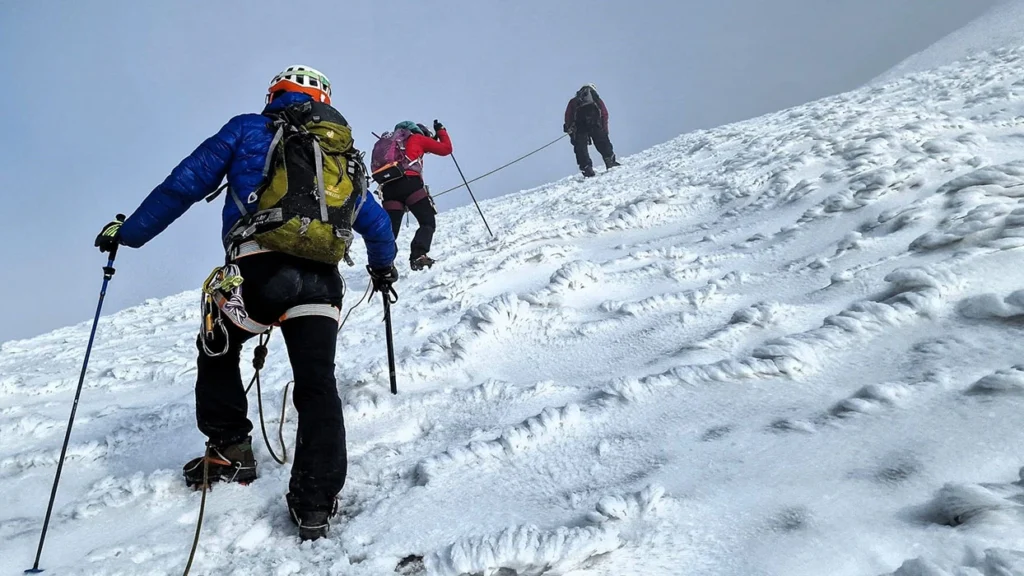
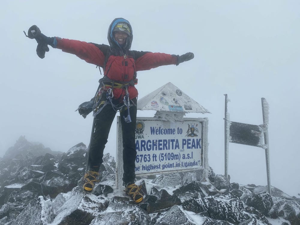
Summit day on the Central Circuit is what the entire preceding journey has been building toward. From Elena Hut, the pre-dawn start, typically 3:00–4:00 AM, takes trekkers across the Stanley Glacier in darkness using headlamps, crossing the glacier bridge and clipping into the fixed ropes installed by the Uganda Wildlife Authority to negotiate the crevasse system safely. Ice axes and crampons are standard equipment from this point, and RMS guides, all trained in glacier safety and rope management, lead each trekker team through the technical terrain with the confidence built from hundreds of summit ascents. The final ridge to Margherita Peak (5,109 m) is narrow and exposed; the drop on both sides into the glacier cirques is real, and the summit itself, a small, wind-scoured rocky point ringed by ancient ice, delivers the kind of clarity that only Africa’s highest places produce. On a clear morning, the view extends east across Uganda toward Lake Edward; to the west, the forested ridges of the DRC extend toward the Congo basin.
Days 6–7: Descent via Kitandara, Freshfield Pass, and Guy Yeoman Hut
The return stages of the Central Circuit diverge from the ascent route, heading south from Elena through the Kitandara valley and ascending the Freshfield Pass (4,282m) before descending to Guy Yeoman Hut (3,261m) on day six, and then completing the final descent back through the forest zone to Nyabitaba and the trailhead on day seven. The descent is faster than the ascent but requires equal concentration: the steep, rooted forest trails in wet conditions are particularly hard on the knees, and the shift from high alpine exposure to the humid warmth of the montane forest in a single day is a marked sensory change. For those wanting a shorter version of the return section, the 5-day hike to Bujuku and back uses a similar lower-circuit route without ascending to the glacial upper zones.
Central Circuit Trek Itineraries: Choosing the Right Schedule
The Central Circuit accommodates a range of itineraries depending on trekking objectives, fitness level, available time, and summit ambitions. All trekking itineraries operated by Rwenzori Trekking Safaris can be customized within the framework of what the mountain and trail conditions allow.
6-day Margherita Peak Trek
The 6-day Margherita Peak itinerary is the most compressed full-circuit option, covering the core stages at a brisk pace suited to experienced high-altitude trekkers with strong fitness and, ideally, some previous acclimatization history. It allows for the Margherita summit attempt but provides limited margin for acclimatization issues or weather delays.
The 7-day Central Circuit is the most popular and most recommended option for the majority of trekkers. It provides a better acclimatization profile, more time to absorb the extraordinary scenery, and a more measured ascent to Margherita Peak. For most trekkers visiting the Rwenzori for the first time, the 7-day itinerary represents the best balance between ambition and safety.
For those whose ambitions extend to multiple summits, the 9-day three-peaks expedition adds Mount Speke and Mount Baker to the Margherita summit in a single continuous itinerary, using the Central Circuit as its backbone. This is the route for serious mountaineers who want the most complete Rwenzori summit experience available in under two weeks.
At the apex of Rwenzori ambition, the 13-day, six-peaks grand expedition traverses all six major massifs: Mount Stanley, Mount Speke, Mount Baker, Mount Luigi di Savoia, Mount Emin, and Mount Gessi in a single, sustained expedition. This is the ultimate Rwenzori challenge, demanding both exceptional fitness and genuine technical mountaineering competence.
Physical Difficulty, Terrain, and Fitness Requirements.
It is important to be direct about the Central Circuit’s demands. This is not a gentle highland walk or a straightforward scramble. The route involves sustained steep hiking over genuinely technical terrain, in conditions that are almost always wet, frequently cold, and occasionally freezing above 4,000 metres. The combination of altitude, exposure, mud, and physical effort makes it one of the most challenging multi-day treks in Africa, harder, in most trekkers’ experience, than any standard Kilimanjaro route, despite its lower maximum elevation of 5,109 metres versus Kilimanjaro’s 5,895 metres. Detailed training recommendations are available in the Rwenzori fitness and training guide, and honest assessment of whether the circuit is appropriate for new trekkers is provided in the beginner’s guide to Rwenzori climbing.
The technical difficulty varies by section. The forest and heather stages are non-technical in the climbing sense but physically demanding, with sustained steep terrain, complex root systems, and the constant need for careful footwork in wet and muddy conditions. The bog sections, even with boardwalks, demand concentration and a certain willingness to accept wet feet. The upper alpine terrain above 4,000 metres involves scrambling on loose and wet rock and some exposed ridge traversals. The Margherita summit section requires basic mountaineering skills: glacier travel, crampon use, fixed-rope clipping, and the mental composure to move efficiently on exposed glacial terrain with a significant drop below.
Trekkers who have never used crampons benefit significantly from familiarization before departure. Those who have previous alpine or high-altitude experience, whether in the Alps, on Kilimanjaro, or elsewhere, will find the summit day significantly less stressful than absolute beginners. Older trekkers over 50 or 60 can and do complete the Central Circuit successfully, though the physical preparation required is, if anything, even more important than for younger trekkers, and the timeline for training should be correspondingly longer.
Altitude and Acclimatization on the Central Circuit
Altitude sickness poses a genuine risk on the Central Circuit and requires serious attention. The route spends multiple nights between 3,400 and 4,541 metres, with the summit push reaching 5,109 metres, and while the ascent profile is more gradual than a direct approach to similar altitudes on other mountains, Acute Mountain Sickness (AMS) remains a real concern for any trekker ascending from sea level without prior acclimatization.
The key symptoms of AMS persistent headache, nausea, loss of appetite, fatigue, and disturbed sleep, typically appear above 2,500 metres in susceptible individuals. More serious conditions, High Altitude Pulmonary Oedema (HAPE) and High Altitude Cerebral Oedema (HACE), can develop rapidly if AMS is ignored or if trekkers continue ascending while symptomatic. All RMS guides carry supplementary oxygen and are trained in altitude illness recognition and management. The prescription medication Diamox (acetazolamide) is widely used as a prophylactic by trekkers on the circuit, though it should be discussed with a medical professional before departure.
The golden rule on the Central Circuit, as on any high-altitude route, is to descend immediately at the first signs of serious altitude illness regardless of summit ambition. No summit justifies the risk of ignoring HAPE or HACE. The seven-day itinerary is specifically designed to provide meaningful acclimatization time at John Matte Hut (3,414 m) before ascending to the higher stages, and this intermediate period makes a measurable difference to summit success rates and overall trekker well-being.
Best Time to Trek the Rwenzori Central Circuit
The Rwenzori is one of the wettest mountain ranges in the world, and this designation is not a qualifier that applies only to the rainy season: there is effectively no fully dry season in the Rwenzori. Rainfall can and does occur in every month of the year, and the mountain creates powerful local microclimates that can override regional weather patterns at any time. The best time to visit the Rwenzori guide provides the most detailed guidance on seasonal conditions, and this section summarizes the key principles.
Two windows provide relatively more stable conditions: January to February and June to August. During these drier periods, precipitation is somewhat reduced, cloud cover is less persistent, and trail conditions while still wet in the upper zones are marginally less arduous than during the heavy rain seasons. Summit visibility is also more likely to be clear during these windows, and the chances of open, panoramic views from the Scott Elliot Pass and Margherita Peak are highest.
The most genuinely difficult months to trek the Central Circuit are March to May and October to November, when sustained rainfall makes the lower forest trails deeply muddy, the bog sections particularly hazardous, and the upper glacier approaches more complex due to additional snowfall. However, even during these periods, expect complete days of rainfall interspersed with clear mornings and remarkable light. The Rwenzori’s botanical spectacle, the giant lobelias, the moss-wrapped heather, and the carpets of everlastings in the alpine zone are at their most vividly green year-round, and the ‘difficult’ seasons produce some of the most photographically dramatic conditions the mountain offers.
The practical takeaway is this: prepare for rain in every season. Waterproof gear from head to foot, over-boot waterproof covers, and a genuinely submersible dry bag for sleeping equipment are not optional extras on the Central Circuit; they are core requirements regardless of the month you choose.
What to Pack for the Central Circuit
Packing correctly for the Central Circuit is one of the most important preparations any trekker can make. A layering system is both essential and complex due to the mountain’s combination of tropical heat in the lower forest, cold and wind in the upper heather zone, freezing temperatures at the glacier huts, and persistent moisture throughout. A full, detailed Rwenzori packing and gear list covering every item category, clothing, footwear, sleeping equipment, technical gear, health supplies, and photography kit is available on the website; the principles are covered here.
For any Rwenzori trekker, footwear represents the single most important equipment decision. The standard recommendation from experienced guides is rubber Wellington boots or neoprene rubber boots for the lower trail sections and bog crossings, with a pair of waterproof hiking boots available for the upper alpine and glacier sections. The combination of these two footwear systems reflects the Central Circuit’s unique terrain: the bog sections and lower forest trails in heavy rain conditions are best served by rubber boots that can be submerged without consequence, while the technical upper terrain requires the ankle support, sole grip, and crampon compatibility of a proper mountain boot. The gear list provides specific recommendations for each section.
For sleeping, a bag rated to at least -5°C is recommended for the upper huts, where temperatures regularly fall to zero and occasionally below. A sleeping bag liner significantly extends the thermal performance of any bag and adds important hygiene benefits in the hut environment. For summit day, technical layers including a mid-weight fleece and a windproof shell are essential, and waterproof shell trousers should be on every trekker’s kit list for the high terrain regardless of the forecast.
Guides, Porters, and the Bakonzo Community
Every trekker on the Central Circuit is required to hire a registered guide and porters, a non-negotiable regulation of Rwenzori Mountains National Park. This requirement is not a bureaucratic formality: it is a genuine safety measure and a significant economic structure. The guides provided by Rwenzori Mountaineering Services are expert mountain professionals who know every section of the trail intimately, understand the terrain and weather patterns with the familiarity of repeated experience, carry emergency equipment, and manage the considerable logistical complexity of multi-day high-altitude expeditions with impressive efficiency.
The porters, almost exclusively Bakonzo men from the communities living at the mountain’s base in Kasese District, are extraordinary athletes. They carry loads of 18–20 kilograms over the same terrain that well-equipped trekkers find demanding with a 10-kilogram daypack, and they do so with a matter-of-fact physical capability that is simultaneously inspiring and humbling. The porter system is also the main way that trekking on the Central Circuit directly supports the surrounding communities: guide fees, porter wages, and hut charges go straight to Bakonzo households.
A percentage of every safari conducted by Rwenzori Trekking Safaris is donated directly to supporting Bakonzo community programs, including support for orphaned children, schools, and homes. This commitment reflects the belief that responsible mountain tourism must be inseparable from genuine community benefit.
Getting to the Rwenzori Mountains: Trailhead Logistics
The Central Circuit trailhead at Nyabisindu is located near the village of Nyakalengija, approximately 22 kilometers from Kasese, the primary gateway town to the Rwenzori Mountains in western Uganda. Kasese is served by the main Kampala-Kasese highway, which is generally in excellent condition; the drive from Kampala takes five to six hours, passing through Fort Portal, a pleasant small city that serves as an alternative pre-trek base.
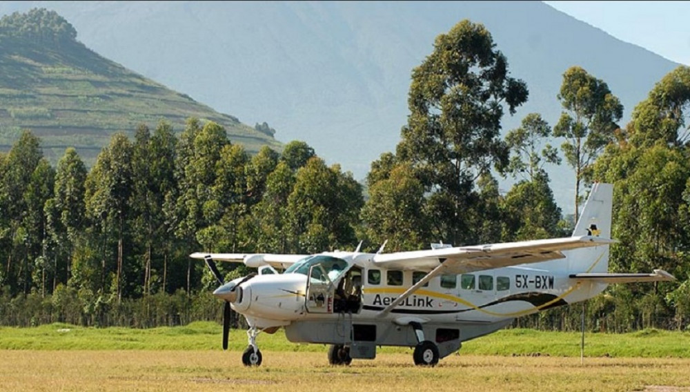
For international visitors, Entebbe International Airport is the primary arrival point. From Entebbe, the most practical approach is to either drive directly to Kasese (6–7 hours) with an overnight stop en route or fly internally to Kasese Airport if available, then complete transfer arrangements to the trailhead. Comprehensive travel logistics, including visa requirements, health prerequisites, airport transfers, and recommended pre-trek accommodation in Kasese, are detailed in the full guide to getting to the Rwenzori Mountains. Transfer from Kasese to the Nyabisindu Trailhead takes approximately 45 minutes by vehicle along an increasingly rough track and is included in Rwenzori Trekking Safaris’ guided packages.
Costs and Permits for the Central Circuit
Trekking the Central Circuit involves several distinct fee components: the Rwenzori Mountains National Park entrance fee (payable to the Uganda Wildlife Authority), the RMS concession fee, guide fees, porter fees, and hut charges. Together, these fees add up to a significant daily cost, but the expense is clearly justified by the UNESCO-protected status of the park and the major investment needed to maintain the trail, huts, and boardwalk systems in this challenging environment.
All-inclusive guided packages from Rwenzori Trekking Safaris cover all of these components in a single transparent price, eliminating the complexity of arranging fees and permits independently. A full and honest breakdown of every cost component, including what is and is not included and how different itinerary lengths affect total investment, is available in the complete guide to the cost of climbing the Rwenzori Mountains. To get personalized quotes based on group size, itinerary length, and specific objectives, contact the team directly.
Central Circuit vs. Kilembe Trail: Which Route Should You Choose?
The Kilembe Trail is the other major Rwenzori trekking route, starting from the former copper-mining town of Kilembe and ascending from the southeast under the management of Rwenzori Trekking Services (RTS). Both trails reach the high mountain zone and provide access to the same summits via different approaches; however, their characters are significantly different.
The Central Circuit is the longer, more established route with a superior hut infrastructure, broader accessibility, and the most direct approach to the Margherita Peak summit via Elena Hut. Its decades of operation have produced well-maintained infrastructure and guides with deep accumulated route knowledge. The Kilembe Trail is widely considered more technically demanding in its lower sections, with steeper terrain and different camp elevations. The detailed, honest comparison of both trails, including difficulty, scenery, duration, camps, summits, and which trekker each route suits best, is provided in the expert guide: Central Circuit vs. Kilembe Trail.
For first-time Rwenzori trekkers, the Central Circuit remains the more recommended starting point: its infrastructure is more established, its hut system more consistent, and its overall difficulty curve slightly better calibrated for the broad range of international trekkers. The Kilembe Trail particularly suits those returning for a second Rwenzori expedition and seeking a different perspective on the mountains’ terrain.
The Disappearing Glaciers: A Reason for Urgency
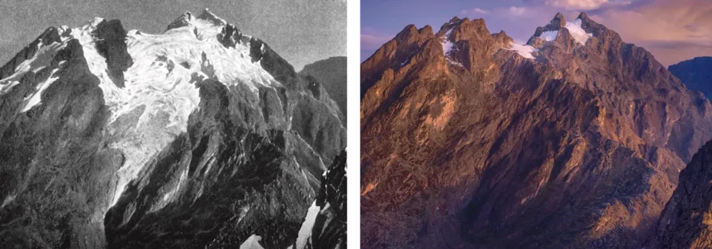
Any complete guide to the Central Circuit must address what is, by any measure, the most urgent environmental story that the Rwenzori holds. The glaciers of the Rwenzori are disappearing. When the Duke of Abruzzi stood on Margherita Peak in 1906, vast permanent icefields covered approximately 6.5 square kilometers of the range. Scientific surveys confirm that less than 1 square kilometer of glacier ice remains today, a loss of over 80% in a single century. Current projections, based on observed retreat rates and regional climate modeling, suggest the remaining ice may vanish entirely before 2050.
This is not an abstract environmental statistic for those planning to walk the Central Circuit: it is the lived reality of every summit day. Standing on the Stanley Glacier, crossing the glacier bridge to the Margherita summit approach, and looking up at the ice seracs and snow cornices of Africa’s last equatorial ice these are experiences that may not be available to the next generation of trekkers. The Rwenzori’s glaciers are a living monument to the continent’s climate history, and their imminent loss gives every Central Circuit expedition a quality of witness that transcends ordinary mountain adventure.
The Uganda Wildlife Authority’s investment in the glacier bridge and fixed rope system was itself a response to this changing reality: as the glacier retreats, new crevasse systems are exposed that require managed crossing infrastructure. The bridge makes the summit approach safer in the current glacial configuration, and its installation represents the kind of adaptive management that allows the Rwenzori trekking experience to continue even as the mountain changes beneath our feet. Trek the Central Circuit now, with urgency and with gratitude.
If you need any clarification about a Rwenzori trek, contact one of our trekking experts to start planning your journey today.
A 10% percentage of your safari proceeds goes to supporting the local Bakonjo Communities (orphans, schools & homes)
Simply incredible
I have been very fortunate to go trekking and climbing in many incredible places around the world over the years, the Rwenzori mountains are one of the most incredible places I have ever visited. Rwenzori Trekking Safaris organized my trip to do the central circuit and summit Margherita peak. The guides, Josephat and Joackim, and porters were all friendly and helpful. The food was plentiful, but I suggest bringing some of your own day snacks you might like as well as rubber knee high boots, I suggest LaCrosse Burly Aero. I was able to complete the loop and peak in 4 days, but most people take 7-8 days I believe which is definitely recommended for acclimatization. There are new huts being built at Elena camp and Nyabitaba that cost a small amount extra, so ask about that too. Its a real adventure and in my experience way more rugged, beautiful, and less traveled than Kilimanjaro. The landscapes and unique plant life are like out of Jurassic Park.
Posted on Tripadvisor
Simon B
Verified
A wonderful experience in the Rwenzoris
We did the seven-day Central Circuit and had a wonderful experience. The landscapes were spectacular and really diverse. Also, the guides, porters and cooks were super friendly and helpful. Thank you very much!
Posted on Tripadvisor
Explorer43375006028
Verified
Magical mountain forest
We did the two day hike to Mahoma Lake, and it was beautiful. The guide was superfriendly, the coock made a great stew and the porters were really nice.
Posted on Tripadvisor
Dominic N
Verified
Forget Kilimanjaro, do this instead!
A beautiful and surreal 4 day hike in the Rwenzori mountains to Mutinda Lookout, made by the staff. Good food, good basic camp accommodation, excellent knowledge of the guides and lots of laughs. I did this trip solo and joined a welcoming group of 6. Pack for all weather, it gets particularly cold at night at Mutinda camp. Total cost was $635/2.2m UGX
Verified by Trustindex
Trustindex verified badge is the Universal Symbol of Trust. Only the greatest companies can get the verified badge who has a review score above 4.5, based on customer reviews over the past 12 months. Read more
The Rwenzori Central Circuit Trail covers approximately 55 to 60 kilometers in total distance, depending on the specific peak climbs undertaken as part of the expedition. Because the route follows a loop rather than an out-and-back path, trekkers move through different valleys and pass different landscapes on the ascent and descent stages. Most trekkers complete the full circuit, including the Margherita Peak summit attempt, in seven days, the itinerary that provides the best balance between pace, acclimatisation time, and the opportunity to fully absorb the trail’s extraordinary ecological variety.
The Central Circuit is widely considered more physically demanding than any standard Kilimanjaro route, despite reaching a lower maximum elevation of 5,109 metres versus Kilimanjaro’s 5,895 metres. The greater difficulty comes from the combination of sustained wet and muddy terrain, complex bog crossings, steep and rooted forest trails, technical glacier travel on summit day, and the persistent cold and damp of the higher elevations. While Kilimanjaro routes follow relatively straightforward paths with even footing, the Central Circuit demands technical footwork and physical adaptability in challenging conditions throughout.
For the core circuit stages below Margherita Peak, strong trekking fitness and good experience on mountain trails are sufficient. For the Margherita Peak summit, the objective of most Central Circuit trekkers is a basic familiarity with crampons and fixed-rope techniques, which is highly beneficial, though not strictly mandatory since RMS guides manage the technical glacier sections. First-time glacier users are guided safely through the summit approach, but trekkers who have done any previous alpine climbing will find summit day considerably less stressful and more enjoyable than those with no prior technical experience whatsoever.
The two most favorable windows for Central Circuit trekking are January to February and June to August, when rainfall is somewhat reduced, cloud cover is less persistent, and summit visibility is most reliably clear. However, the Rwenzori creates powerful local weather patterns that can override any regional forecast, and rain can occur in every month. The most challenging conditions are found during the heavy rain seasons of March to May and October to November, when trail mud, bog hazard, and reduced visibility are most pronounced. Whatever season you choose, you must wear full waterproof gear from head to foot.
The Central Circuit has six main huts managed by Rwenzori Mountaineering Services: Nyabitaba Hut (2,652 m), John Matte Hut (3,414 m), Bigo Hut (3,996 m), Bujuku Hut (3,962 m), Elena Hut (4,541 m), and Guy Yeoman Hut (3,261 m). Each hut provides bunk accommodation with foam mattresses, basic cooking facilities for the support team to prepare meals, and emergency weather shelter. The hut system is one of the Central Circuit’s significant practical advantages over other East African high-altitude routes: it eliminates the need for tent camping equipment, allows guided cook teams to prepare hot meals at each overnight stop, and provides reliable shelter regardless of external conditions.
The full Central Circuit to Margherita Peak does not suit complete beginners with no prior hill-walking or mountain trekking experience. The route’s sustained physical demands, technical summit section, and challenging weather conditions require a genuine fitness base and the mental resilience built by previous mountain experience. However, fit and well-prepared beginners who commit to a structured training program in the months before the trek and who are guided by experienced RMS guides have successfully completed the circuit. For those newer to mountain trekking, introductory options including the 1-day Nyabitaba hike and the 5-day Bujuku circuit provide excellent entry points into the Rwenzori environment without the full demands of the summit route.
Yes. The Uganda Wildlife Authority installed the glacier bridge and new fixed rope system on the Margherita approach specifically to address safety concerns created by glacier retreat, which had exposed crevasse systems previously buried under deeper ice. With these improvements in place, the current route to Margherita Peak is assessed as safe for guided trekkers equipped with appropriate technical equipment and competent guiding. As with all glacier travel, conditions are dynamic, and RMS guides continuously monitor route safety, but the infrastructure investment has specifically resolved the primary technical hazard that had previously complicated the summit approach.
The total cost of trekking the Central Circuit inclusive of national park entry fees, RMS concession fees, guide fees, porter fees, and hut charges varies by itinerary length, group size, and the number of peaks included in the expedition. All-inclusive guided packages from Rwenzori Trekking Safaris cover all components in a single transparent price. Full cost breakdowns are available on the cost of climbing the Rwenzori Mountains page, and personalized quotes for specific itinerary requests can be obtained by contacting the team directly.
Yes, a registered guide is mandatory on the Central Circuit, and solo and unguided trekking is not permitted in Rwenzori Mountains National Park. This requirement is in place for important safety reasons: the trail is genuinely remote, the terrain is serious, and altitude illness can develop quickly and require immediate professional response, as well as to protect the fragile UNESCO-listed ecosystems along the route. All guides are provided by Rwenzori Mountaineering Services and are trained professionals with deep route knowledge, first aid certification, altitude illness management skills, and glacier safety training.
The Central Circuit is the older, more established route with a superior hut infrastructure and the most direct approach to the Margherita Peak summit via Elena Hut. It is generally recommended as the better starting route for first-time Rwenzori trekkers due to its more consistent infrastructure and slightly more accessible difficulty curve. The Kilembe Trail offers a different and in many respects more technically demanding route into the high mountain zone, with different camp elevations and a steeper lower section that many trekkers find more physically challenging. Both routes deliver an exceptional Rwenzori experience; the choice depends on prior experience, specific interests, and whether an alternative perspective on a second visit is the objective.
Begin Your Central Circuit Trek: Start Planning Today
There is a mountain in Africa that has been waiting for you. Its trails are older than the roads that brought you to its gate; its forests have watched explorers, scientists, and mountaineers pass through for more than a century. The Rwenzori Central Circuit Trail is not merely a route through extraordinary terrain; it is a complete immersion into one of the most remarkable natural environments remaining on this planet, a journey through five stacked ecological worlds in a single week, and for those who reach its highest point, a standing on glacial ice at the equator that very few people in any generation have the fortune to experience.
Rwenzori Trekking Safaris exists to make that experience as safe, as well-managed, and as unforgettable as possible. Our expert Bakonzo guides have walked every section of the Central Circuit hundreds of times. We carefully refine and reliably execute our logistics. Our commitment to the communities at the mountain’s base, including the direct contribution of a percentage of every safari’s proceeds to Bakonzo orphan support, schools, and community homes, is genuine and enduring.
The Rwenzori’s glaciers are retreating. The mountain is changing. The window for standing on equatorial ice in Africa narrows with every passing year. This is not manufactured urgency; it is the documented reality of a mountain in the midst of irreversible climate-driven transformation. Reach out to our team through the contact page, and a dedicated specialist will be in touch within 24 hours with personalized itinerary options, practical preparation advice, and everything you need to begin preparing for one of the most extraordinary remaining mountain adventures on Earth. The Central Circuit is ready. The question is whether you are.
Hi there, welcome. Need help planning a trek, safari, or adventure? Chat directly with a real expert and mountain guide for honest advice, clear answers, and practical recommendations. No guesswork, no pressure.